Other ID: none
Status: Completed
Organization(s): USGS, Woods Hole Coastal and Marine Science Center
Funding Program(s): Hurricane Sandy - Coastal Vulnerability and Resource Assessment, Delmarva Peninsula (AE03FKC)
Principal Investigator(s): Laura Brothers, E. Robert Thieler
Affiliate Investigator(s): Carter DuVal, Univ Delaware (grad student)
Information Specialist(s): Elizabeth Pendleton
Data Type(s): Environmental Data: Current, Environmental Data: Wave, Location-Elevation: Navigation, Sampling: Geology, Seismics: Boomer, Seismics: Multichannel, Seismics: Sub Bottom Profiler, Sonar: Interferometric, Sonar: Sidescan, Sonar: Sound Velocity, Imagery: Photo
Scientific Purpose/Goals: map inner shelf bathymetry, surficial sediment type, geologic framework
Vehicle(s):
Start Port/Location: Woods Hole (van mob); Ocean City, MD (people)
End Port/Location: Ocean City, MD (some gear, people); Woods Hole (van demob)
Start Date: 2014-06-16
End Date: 2014-07-25
Equipment Used: GoPro camera, SeaBOSS, GeoEel 16-channel hydrophone, ADCP 300 kHz, Real Time Kinematic GPS, SEA SWATHplus-M 234 kHz, Sensor - MVP30 (Odim), Klein 595 100/500kHz sidescan sonar, DGPS, S-Boom seismic source, Edgetech chirp subbottom profiler 512i
Information to be Derived: Sea floor map;Bathymetric maps;Seismic stratigraphic framework
Summary of Activity and Data Gathered: Collected swath bathymetry, sidescan sonar, chirp and multi-channel seismic reflection, bottom photos, sediment samples, and ADCP data
Staff: Seth Ackerman, Wayne Baldwin, Emile Bergeron, Laura Brothers, William Danforth, David Foster, Alexander Nichols, E. Robert Thieler, Charles Worley
Affiliate Staff:
Notes: Vans, winches, gear were loaded in Woods Hole on Friday 13 June. Final cruise mobilization Ocean City, MD was Monday 16 June. Initial cruise demob Ocean City, MD on Friday, 25 July. Vans, winches were unloaded Woods Hole on Monday, 28 July.
Crew change on Tuesday 01 July.
other equipment:
Klein 3000 Sidescan sonar 100 &500 kHz
Edgetech 512i subbottom profiler
Location:
Delmarva peninsula, United States, North America, North Atlantic
| Boundaries | |||
|---|---|---|---|
| North: 38.45454474 | South: 37.51214671 | West: -75.61279904 | East: -74.67105018 |
Platform(s):
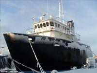 Scarlett Isabella |
Ellis, A.M., Shaw, J.E., Osterman, L.E., Smith, C.G.,, 2018, The Foraminifera of Chincoteague Bay, Assateague Island, and the Surrounding Areas: a Regional Distribution Study: Journal of Foraminiferal Research, v. 48 no. 3, pp. 223–240, doi: 10.2113/gsjfr.48.3.223.
Ellis, A.M., Wheaton, C.J., Smith, C.G., 2017, Archive of sediment physical properties and grain-size data for sediment samples collected offshore of Assateague Island, Maryland and Virginia: U.S. Geological Survey data release, https://doi.org/10.5066/F7HX19WB.
Brothers, L.L., Thieler, E.R., Pendleton, E.A., 2014, Hurricane Sandy: Linking Coastal Processes and Vulnerability along the Delmarva Peninsula: .
Brothers, L.L., Foster, D.S., Pendleton, E.A., Thieler, E.R., 2015, Distribution and Tentative Ages of an Extensive Paleochannel Network Offshore of the Delmarva Peninsula. [abs.]: , GSA 2015 Fall Annual Meeting. Baltimore, MD, November 1-4, 2015.
Brothers, L.L., Thieler, E.R., Pendleton, E., Foster, D., Danforth, W., Baldwin, W., Ackerman, S., 2014, New Regional-Scale Geophysical Observations of the Delmarva Peninsula, U.S.A. Inner Continental Shelf [abs.]: , 2014 AGU Fall Meeting.
Foster, D.S., Brothers, L.L., Baldwin, W.E., and Pendleton, E.A., 2023, Geospatial data layers of shallow geology from the inner continental shelf of the Delmarva Peninsula, including Maryland and Virginia state waters: U.S. Geological Survey data release, https://doi.org/10.5066/P9GQY0ZN.
Pendleton, E.A., Brothers, L.L., Thieler, E.R., and Sweeney E.M., 2017, Sand ridge morphology and bedform migration patterns derived from bathymetry and backscatter on the inner-continental shelf offshore of Assateague Island, USA: Continental Shelf Research, v. 144, p. 80-97, https://doi.org/10.1016/j.csr.2017.06.021.
Pendleton, E.A., Sweeney, E.M., and Brothers, L.L., 2019, Optimizing an inner-continental shelf geologic framework investigation through data repurposing and machine learning: Geosciences, v. 9, issue 6, https://doi.org/10.3390/geosciences9050231.
Pendleton, E.A., Ackerman, S.D., Baldwin, W.E., Danforth, W.W., Foster, D.S., Thieler, E.R., and Brothers, L.L., 2016, High-resolution geophysical data collected along the Delmarva Peninsula, 2014, USGS Field Activity 2014-002-FA (ver. 4.0, October 2016): U.S. Geological Survey data release, https://doi.org/10.5066/F7MW2F60.
Pendleton, E.A., Brothers, L.L., Sweeney, E.S., Thieler, E.R., and Foster, D.S., 2017, Sediment texture and geomorphology of the sea floor from Fenwick Island, Maryland to Fisherman's Island, Virginia: U.S. Geological Survey data release, https://doi.org/10.5066/F78K779J.
Wehmiller, J.F., Brothers, L.L., Ramsey, K.W., Foster, D.S., Mattheus, C.R., Hein, C.J., Shawler, J.L., 2021, Molluscan aminostratigraphy of the US Mid-Atlantic Quaternary coastal system: Implications for onshore-offshore correlation, paleochannel and barrier island evolution, and local late Quaternary sea-level history: Quaternary Geochronology doi:10.1016/j.quageo.2021.101177.
| Survey Equipment | Survey Info | Data Type(s) | Data Collected |
|---|---|---|---|
| GoPro camera | Mounted on the SEABOSS sampling system to acquire seabed photos and video. | Photo Video | 2014-002-FA_photos (Location of bottom photographs along with images collected by the U.S. Geological Survey in 2014 along the Delmarva Peninsula, MD and VA (JPEG images and Esri point shapefile, Geographic, WGS 84) |
| SeaBOSS | Modified Van Veen sampler mounted with GoPro cameras on the Seaboss | Surveys (biological) Experiments (biological) Species ID Photo Video Geology Biology | 2014-002-FA_samples (Location and analysis of sediment samples collected by the U.S. Geological Survey in 2014 along the Delmarva Peninsula, MD and VA (Esri point shapefile and CSV file, Geographic, WGS 84)) |
| GeoEel 16-channel hydrophone | MCS seismic data were collected using S-Boom source and a 100-m long GeoEel 16 channel streamer. | Multichannel | 2014-002-FA_MCS_rp100 (Reflection point navigation at 100 trace intervals for multichannel boomer seismic-reflection data collected by the U.S. Geological Survey along the Delmarva Peninsula, MD and VA, 2014 (Esri point shapefile and CSV, GCS WGS 84)) 2014-002-FA_MCS_Tracklines (Tracklines of multichannel boomer seismic-reflection data collected by the U.S. Geological Survey along the Delmarva Peninsula, MD and VA, 2014 (Esri polyline shapefile, GCS WGS 84)) 2014-002-FA_MCS_Images (Multi-channel boomer seismic-reflection profiles collected by the U.S. Geological Survey along the Delmarva Peninsula, MD and VA, 2014) |
| ADCP 300 kHz | --- | Current Wave | |
| Real Time Kinematic GPS | --- | Navigation | |
| SEA SWATHplus-M 234 kHz | used to acquire swath bathymetry and backscatter | Interferometric | 2014-002-FA_5m_MLLWbathy (5-meter Swath bathymetry data collected by the U.S. Geological Survey along the Delmarva Peninsula, MD and VA, 2014 (32-bit GeoTIFF, UTM Zone 18N, WGS 84)) 2014-002-FA_Swath_Tracklines (Trackline navigation for Swath bathymetry collected by the U.S. Geological Survey along the Delmarva Peninsula, MD and VA, 2014 (Esri polyline shapefile, GCS WGS 84)) 2014-002-FA_SwathBS_2m (2-meter Swath interferometric backscatter data collected in 2014 by the U.S. Geological Survey along the Delmarva Peninsula, MD and VA (8-bit GeoTIFF, UTM Zone 18N, WGS 84)) |
| Sensor - MVP30 (Odim) | These data are collected to supply to swath interferometric raw data to correct for CTD changes (refraction) in the water column | Sound Velocity | MVP profile images and locations (shapefile) (Location of sound velocity profiles along with profile plots collected by the U.S. Geological Survey in 2014 along the Delmarva Peninsula, MD and VA (PNG images, CSV text, and Esri point shapefile, GCS, WGS 84)) |
| Klein 595 100/500kHz sidescan sonar | Used to acquire high and low frequency sidescan sonar | Sidescan | 2014-002-FA_Klein_Tracklines (Trackline navigation for Klein 3000 sidescan-sonar data collected by the U.S. Geological along the Delmarva Peninsula, MD and VA, 2014 (Esri polyline shapefile, GCS WGS 84)) 2014-002-FA_Klein_1m (1-meter sidescan-sonar mosaic image collected by the U.S. Geological Survey along the Delmarva Peninsula, MD and VA, 2014 (GeoTIFF, UTM Zone 18N, WGS 84)) |
| DGPS | DGPS used to log navigation through HYPACK | Navigation | 2014-002-FA_HYPACK (Text files of the navigation logged with HYPACK Software during survey 2014-002-FA conducted by the U.S. Geological Survey along the Delmarva Peninsula, MD and VA, 2014) |
| S-Boom seismic source | MCS seismic data were collected using S-Boom source and a 100-m long GeoEel 16 channel streamer | Boomer | |
| Edgetech chirp subbottom profiler 512i | --- | Sub Bottom Profiler | 2014-002-FA_512i_500sht (Shot point navigation at even 500 shot intervals for Edgetech SB-512i seismic-reflection data collected by the U.S. Geological Survey along the Delmarva Peninsula, MD and VA, 2014 (Esri point shapefile and CSV, GCS WGS 84)) 2014-002-FA_512i_Tracklines (Trackline navigation for Edgetech SB-512i seismic-reflection data collected by the U.S. Geological Survey along the Delmarva Peninsula, MD and VA, 2014 (Esri polyline shapefile, GCS WGS 84)) 2014-002-FA_512i_Images (PNG formatted images of Edgetech SB-512i chirp seismic-reflection profiles collected by the U.S. Geological Survey along the Delmarva Peninsula, MD and VA, 2014) |
