Other ID: none
Status: Completed
Organization(s): USGS, Woods Hole Coastal and Marine Science Center
Funding Program(s): Coastal Change Processes (LQ00CNK)
Principal Investigator(s): John Warner
Affiliate Investigator(s):
Information Specialist(s): Ellyn Montgomery
Data Type(s): Location-Elevation: Navigation, Sampling: Geology, Time Series: Mooring (physical oceanography)
Scientific Purpose/Goals: Set 9 moorings and 13 tripods
Vehicle(s):
Start Port/Location: Woods Hole, MA
End Port/Location: Woods Hole, MA
Start Date: 2014-02-03
End Date: 2014-02-13
Equipment Used: Bottom platform, DGPS, Grab sampler, SeaBOSS, Current, Pressure, Turbidity
Information to be Derived: Time series data (currents, waves, pressure, salinity, temperature);Suspended sediment concentrations;
Summary of Activity and Data Gathered: Tripods and watch buoys were deployed, sediment samples were collected for Grain Size analysis, bathymetry was collected with the jetyak
Staff: Dann Blackwood, Jonathan Borden, Patrick Dickhudt, Marinna Martini, Ellyn Montgomery
Affiliate Staff:
Notes: Sponsoring Office:
Woods Hole Coastal and Marine Science Center
Affiliate Principal and Organization (if any):
Peter Traykovsky, WHOI
Number of days at sea:
9
Project Maximum Weekly Overtime for Each:
40 hours
Overtime Project Number:
13/14 GX13LQ00CNK0700
Will Field Activity be at Least Seven Calendar Days With No Port Call (to
calculate shore leave)?
No
Affiliate Personnel and Organization (if any):
Jay Sisson, WHOI
Degree of Certainty:
90%
Report Date:
2013-08-06 14:59:02
Location:
Fire Island, New York, Long Island Sound
| Boundaries | |||
|---|---|---|---|
| North: 40.66123835 | South: 40.61434993 | West: -73.3269 | East: -73.15905151 |
Platform(s):
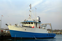
 Connecticut |
| Survey Equipment | Survey Info | Data Type(s) | Data Collected |
|---|---|---|---|
| Bottom platform | moorings and tripods were deployed at several sites | Mooring (physical oceanography) | All platform data from Fire Island Nearshore experiment 2014 |
| DGPS | --- | Navigation | |
| Grab sampler | --- | Biology Geology | |
| SeaBOSS | --- | Surveys (biological) Experiments (biological) Species ID Photo Video Geology Biology | |
| Current | --- | Mooring (physical oceanography) | |
| Pressure | --- | Mooring (physical oceanography) | |
| Turbidity | --- | Mooring (physical oceanography) |