Other ID: none
Status: Completed
Organization(s): USGS, Woods Hole Coastal and Marine Science Center
Funding Program(s): USGS GAS HYDRATES (LQ000FP)
Principal Investigator(s): Carolyn Ruppel
Affiliate Investigator(s):
Information Specialist(s): Carolyn Ruppel
Data Type(s): Location-Elevation: Navigation, Seismics: Boomer, Seismics: Bubble Gun
Scientific Purpose/Goals: Image deeper seismic structure of lake
Vehicle(s):
Start Port/Location: Upper Mystic, MA
End Port/Location: Upper Mystic, MA
Start Date: 2014-04-08
End Date: 2014-04-08
Equipment Used: HYPACK, Boomer, Other, Single channel hydrophone
Information to be Derived: depth of sediment in lake
Summary of Activity and Data Gathered: Data will be used to image gas in lakebed sediments.
Staff: Eric Moore, Charles Worley
Affiliate Staff:
Notes: Entries for this field activity are based on entries from Field Activity 2012-052-FA
Location:
Upper Mystic Lake
| Boundaries | |||
|---|---|---|---|
| North: 42.4463543 | South: 42.43072661 | West: -71.1564 | East: -71.13915322 |
Platform(s):
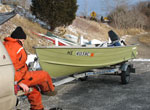 Terrapin |
| Survey Equipment | Survey Info | Data Type(s) | Data Collected |
|---|---|---|---|
| HYPACK | --- | Navigation | |
| Boomer | --- | Boomer | |
| Other | --- | --- | --- |
| Single channel hydrophone | --- | Air Gun / Water Gun Boomer Bubble Gun Sparker Sub Bottom Profiler |
