Other ID: none
Status: Cancelled
Organization(s): USGS, St. Petersburg Coastal and Marine Science Center, USGS, Woods Hole Coastal and Marine Science Center
Funding Program(s): Other (Other)
Principal Investigator(s): Christopher Sherwood
Affiliate Investigator(s):
Information Specialist(s): Patrick Dickhudt
Data Type(s): Time Series: Mooring (physical oceanography)
Scientific Purpose/Goals: Recover ADCP moorings at two locations near Ship Island
Vehicle(s):
Start Port/Location: Biloxi, MS
End Port/Location: Biloxi, MS
Start Date: 2014-11-17
End Date: 2014-11-19
Equipment Used: Bottom platform, Current, Pressure
Information to be Derived: Waves, currents
Summary of Activity and Data Gathered:
Staff: Brandy Armstrong, Jonathan Borden, Patrick Dickhudt, Marinna Martini
Affiliate Staff:
Notes: Have not scheduled Munro yet. Hope to use small quadpods w/ SPORT recovery system.
Entries for this field activity are based on entries from Field Activity 2014-024-FA
Location:
Ship Island, MS, Gulf of America (Gulf of Mexico)
| Boundaries | |||
|---|---|---|---|
| North: 30.26287504 | South: 30.1416259 | West: -89.0246 | East: -88.84397605 |
Platform(s):
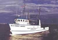 Tommy Munro |
| Survey Equipment | Survey Info | Data Type(s) | Data Collected |
|---|---|---|---|
| Bottom platform | --- | Mooring (physical oceanography) | |
| Current | --- | Mooring (physical oceanography) | |
| Pressure | --- | Mooring (physical oceanography) |
