AKA: none
Other ID: none
Status: Completed
Organization(s): USGS, Pacific Coastal and Marine Science Center
Funding Program(s): Coastal and marine earthquake, tsunami, and landslide active margin field studies (ZP00EQV)
Principal Investigator(s): Daniel Brothers
Affiliate Investigator(s):
Information Specialist(s): David Finlayson, Gerry Hatcher
Data Type(s): Location-Elevation: Navigation, Seismics: Sparker, Seismics: Sub Bottom Profiler, Sonar: Multibeam
Scientific Purpose/Goals: Bathymetric and sub-bottom imagery of megathrust splay faults that ruptured during the 1964 Great Alaskan Earthquake and generated a tsunami that devastated Seward, AK.
Vehicle(s): None
Start Port/Location: Cordova, AK
End Port/Location: Cordova, AK
Start Date: 2014-05-07
End Date: 2014-05-22
Equipment Used: POS MV, Other, 512 chirp, Mini sparker, single channel streamer, Reson 7111
Information to be Derived: coseismic deformation history, acoustic backscatter, seabed characterization
Summary of Activity and Data Gathered: Sparker files on FAD
Staff: David Finlayson, Gerry Hatcher
Affiliate Staff:
Notes: 3/28/14; CR edited equipment list: Reson7111 now multibeam
Location:
Gulf of Alaska and Prince William Sound
| Boundaries | |||
|---|---|---|---|
| North: 60.65164737 | South: 59.05647108 | West: -149.766 | East: -145.84350586 |
Platform(s):
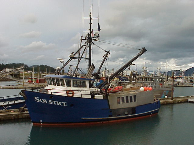 Solstice |
Balster-Gee, A.F., Brothers, D.S., Finlayson, D.P., Liberty, L., Dartnell, P., Hatcher, G.A., Haeussler, P.J., and Byerly, M., 2019, Bathymetry, acoustic backscatter, and minisparker seismic-reflection datasets collected southwest of Montague Island and southwest of Chenega, Alaska during field activity 2014-622-FA: U.S. Geological Survey data release.
| Survey Equipment | Survey Info | Data Type(s) | Data Collected |
|---|---|---|---|
| POS MV | --- | Navigation | |
| Other | --- | --- | --- |
| 512 chirp | --- | Sub Bottom Profiler | |
| Mini sparker | --- | Sparker | |
| single channel streamer | --- | Sparker | Minisparker seismic-reflection data collected southwest of Montague Island and southwest of Chenega, Alaska (High-resolution single channel minisparker seismic-reflection data were collected by the U.S. Geological Survey and the Alaska Department of Fish and Game in May 2014 in southern Prince William Sound southwest of Chenega and from southwest of Montague Island, Alaska. Data were collected aboard the Alaska Department of Fish and Game vessel, R/V Solstice, during field activity 2014-622-FA, using a 500 Joule SIG 2-mille minisparker sound source and a single channel streamer and recorded with a Triton SB-Logger.) |
| Reson 7111 | --- | Multibeam | High-resolution acoustic backscatter data collected southwest of Chenega Island, Alaska (High-resolution acoustic backscatter data were collected by the U.S. Geological Survey (USGS) and the Alaska Department of Fish and Game in May of 2014 southwest of Chenega Island, Alaska. Data were collected aboard the Alaska Department of Fish and Game vessel, R/V Solstice, during USGS field activity 2014-622-FA, using a pole mounted 100-kHz Reson 7111 multibeam echosounder.) High-resolution multibeam bathymetry data collected southwest of Chenega Island, Alaska (High-resolution multibeam data were collected by the U.S. Geological Survey (USGS) and the Alaska Department of Fish and Game in May of 2014 southwest of Chenega Island, Alaska. Data were collected aboard the Alaska Department of Fish and Game vessel, R/V Solstice, during USGS field activity 2014-622-FA, using a pole mounted 100-kHz Reson 7111 multibeam echosounder.) High-resolution acoustic backscatter data collected southwest of Montague Island, Alaska (High-resolution acoustic backscatter data were collected by the U.S. Geological Survey (USGS) and the Alaska Department of Fish and Game in May of 2014 southwest of Montague Island, Alaska. Data were collected aboard the Alaska Department of Fish and Game vessel, R/V Solstice, during USGS field activity 2014-622-FA, using a pole mounted 100-kHz Reson 7111 multibeam echosounder.) High-resolution multibeam bathymetry data collected southwest of Montague Island, Alaska (High-resolution multibeam data were collected by the U.S. Geological Survey (USGS) and the Alaska Department of Fish and Game in May of 2014 southwest of Montague Island, Alaska. Data were collected aboard the Alaska Department of Fish and Game vessel, R/V Solstice, during USGS field activity 2014-622-FA, using a pole mounted 100-kHz Reson 7111 multibeam echosounder.) |
