AKA: none
Other ID: none
Status: Completed
Organization(s): USGS, Pacific Coastal and Marine Science Center
Funding Program(s): Climate Change Impacts to the U.S. Pacific and Arctic Coasts (ZP00F00), Other (Other)
Principal Investigator(s): Ann Gibbs, Bruce Richmond
Affiliate Investigator(s):
Information Specialist(s): Ann Gibbs
Data Type(s): Imagery: Photo, Location-Elevation: Navigation, Location-Elevation: Transects, Sampling: Geology
Scientific Purpose/Goals: Topographic mapping and photographic image acquisition.
Vehicle(s): None
Start Port/Location: Kaktovik, Alaska
End Port/Location: Kaktovik, Alaska
Start Date: 2014-09-01
End Date: 2014-09-08
Equipment Used: camera, Other, Ashtech Z-Xtreme GPS, Hand-grab sample, probe pole
Information to be Derived: Active Layer Thickness measurements and high resolution ground surface elevations coincident with electrical resistivity transects collected during FAN 2014-624_FA.
Summary of Activity and Data Gathered: GPS raw data on FAD; Acquired ground surface elevations and active layer thicknesses along resistivity transects and elsewhere; ground control points for coincident acquisition of aerial photography, and soil and water samples. Retrieved images from 2 time lapse cameras (outfall pipe and snow fence) and redeployed 2 cameras on snow fence.
Staff: Ann Gibbs, Bruce Richmond
Affiliate Staff:
Notes: Coordinating with Tom Reiss to borrow 2-3 Ashtech ZXtremes,tripod, and stadia rods.
Imagery will be acquired using project DSLR and time lapse cameras.
Images from 2014 and 2015 archived under this FAN.
Location:
Barter Island, Alaska
| Boundaries | |||
|---|---|---|---|
| North: 70.1358 | South: 70.112 | West: -143.787 | East: -143.5521 |
Platform(s):
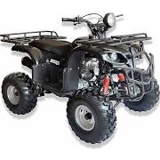
 ATV |  on foot |
Gibbs, A.E., Nolan, M., and Snyder, A.G., 2019, Orthophotomosaics, elevation point clouds, digital surface elevation models and supporting data from the north coast of Barter Island, Alaska: U.S. Geological Survey data release.
| Survey Equipment | Survey Info | Data Type(s) | Data Collected |
|---|---|---|---|
| camera | --- | Photo | |
| Other | --- | --- | --- |
| Ashtech Z-Xtreme GPS | --- | Navigation | |
| Hand-grab sample | --- | Biology Chemistry Geology | |
| probe pole | --- | Geology |