Other ID: none
Status: Completed
Organization(s): USGS, Woods Hole Coastal and Marine Science Center
Funding Program(s): USGS GAS HYDRATES (LQ000FP)
Principal Investigator(s): Carolyn Ruppel
Affiliate Investigator(s):
Information Specialist(s): Carolyn Ruppel
Data Type(s): Geochemical: Surveys (geochemical), Location-Elevation: Navigation, Seismics: Multichannel, Seismics: Sparker, Sonar: Single Beam
Scientific Purpose/Goals: Acquire high-resolution seismics from shelf-break to base of upper slope or deeper through the part of the mid-Atlantic margin where we have identified over 250 upper slope seeps
Vehicle(s):
Start Port/Location: Narragansett, RI
End Port/Location: Narragansett, RI
Start Date: 2015-04-16
End Date: 2015-04-25
Equipment Used: DGPS, Multichannel seismics, Cavity Ring-Down Spectroscopy (CRDS), Other, Sparker , SIMRAD EK60, Raytheon 731 echo sounder
Information to be Derived: seismic profiles
Summary of Activity and Data Gathered: 30 72-channel profiles of varying lengths between north of Wilmington and south of Norfolk canyons, including dip and strike lines and profiles over deepwater seeps; continuous EK60 *raw files for most of the cruise;
Staff: Eric Moore
Affiliate Staff:
Notes: Will also deploy EK60 38 kHz transducer on this cruise.
6 kJ sparker, full 72-channel MCS streamer
Location:
mid-Atlantic US margin
| Boundaries | |||
|---|---|---|---|
| North: 39.88234258 | South: 36.32064415 | West: -75.7178 | East: -71.74023438 |
Platform(s):
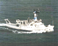 Endeavor |
| Survey Equipment | Survey Info | Data Type(s) | Data Collected |
|---|---|---|---|
| DGPS | --- | Navigation | |
| Multichannel seismics | --- | Multichannel | |
| Cavity Ring-Down Spectroscopy (CRDS) | --- | CO2 Methane Experiments (geochemical) Surveys (geochemical) Chemistry | |
| Other | --- | --- | --- |
| Sparker | --- | Sparker | |
| SIMRAD EK60 | --- | Surveys (biological) Surveys (geochemical) Multibeam Water column reflectivity | |
| Raytheon 731 echo sounder | not | Single Beam | No data was collected |
