Other ID: none
Status: Completed
Organization(s): USGS, Woods Hole Coastal and Marine Science Center
Funding Program(s): Hurricane Sandy - Linking Coastal Processes and Vulnerability – Fire Island Regional Study (AE03FJ6)
Principal Investigator(s): Jonathan Borden
Affiliate Investigator(s):
Information Specialist(s): Ellyn Montgomery
Data Type(s): Time Series: Mooring (physical oceanography)
Scientific Purpose/Goals: Recover existing Waverider buoy and deploy a replacement with fresh batteries
Vehicle(s):
Start Port/Location: Norfolk, VA
End Port/Location: Woods Hole, MA
Start Date: 2015-07-17
End Date: 2015-07-19
Equipment Used: Other
Information to be Derived: Wave height and characteristic data
Summary of Activity and Data Gathered: Recovery of old mooring was successful, deployment of new mooring was not successful. Mooring line broke.
Staff: Dann Blackwood, Jonathan Borden
Affiliate Staff:
Notes: The swap of waverider moorings was accomplished successfully. However the newly deployed buoy was adrift almost immediately, so they recovered it. No vessel has been identified to redeploy the mooring.
Location:
South of Fire Island, NY
| Boundaries | |||
|---|---|---|---|
| North: 40.5846 | South: 40.5843 | West: -73.1068 | East: -73.1066 |
Platform(s):
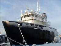
 Scarlett Isabella |
| Survey Equipment | Survey Info | Data Type(s) | Data Collected |
|---|---|---|---|
| Other | --- | --- | --- |