Other ID: 15BIM10, 15BIM11, 15BIM12, 15BIM13
Status: Completed
Organization(s): USGS, St. Petersburg Coastal and Marine Science Center
Funding Program(s): Dauphin Island bathymetry and geophysical surveys (MA00G1V)
Principal Investigator(s): James Flocks
Affiliate Investigator(s):
Information Specialist(s): Julie Bernier, Nancy DeWitt
Data Type(s): Location-Elevation: Benchmarks, Location-Elevation: Navigation, Seismics: Bubble Gun, Sonar: Single Beam
Scientific Purpose/Goals: To collect singlebeam bathymetric and subbottom geophysical data for NFWIF RESTORE Dauphin Island feasibility study.
Vehicle(s): Ford F-350 Dually White (GSA), Ford F-350 Dually - Silver (GSA), Chevy Suburban Silver
Start Port/Location: Dauphin Island, AL
End Port/Location: Dauphin Island, AL
Start Date: 2015-08-19
End Date: 2015-08-25
Equipment Used: Ashtech ProFlex 500 GNSS Receiver, Ashtech ProFlex 800 GNSS Receiver, Choke Ring Antenna, Bubble Pulser, Bubble Pulser Hydrophone Streamer Cable , ODOM-Echotrac CV-100, TSS DMS-05 Motion Sensor
Information to be Derived: Water depth/seafloor elevation, subbottom profiles
Summary of Activity and Data Gathered: 300 singlebeam bathymetry lines (1165 line-km of data) plus 63 bubble pulser sub-bottom profiles collected
Staff: Julie Bernier, Nancy DeWitt, James Flocks, Joseph Fredericks, Kyle Kelso, Chelsea Stalk, Thomas Tuten
Affiliate Staff:
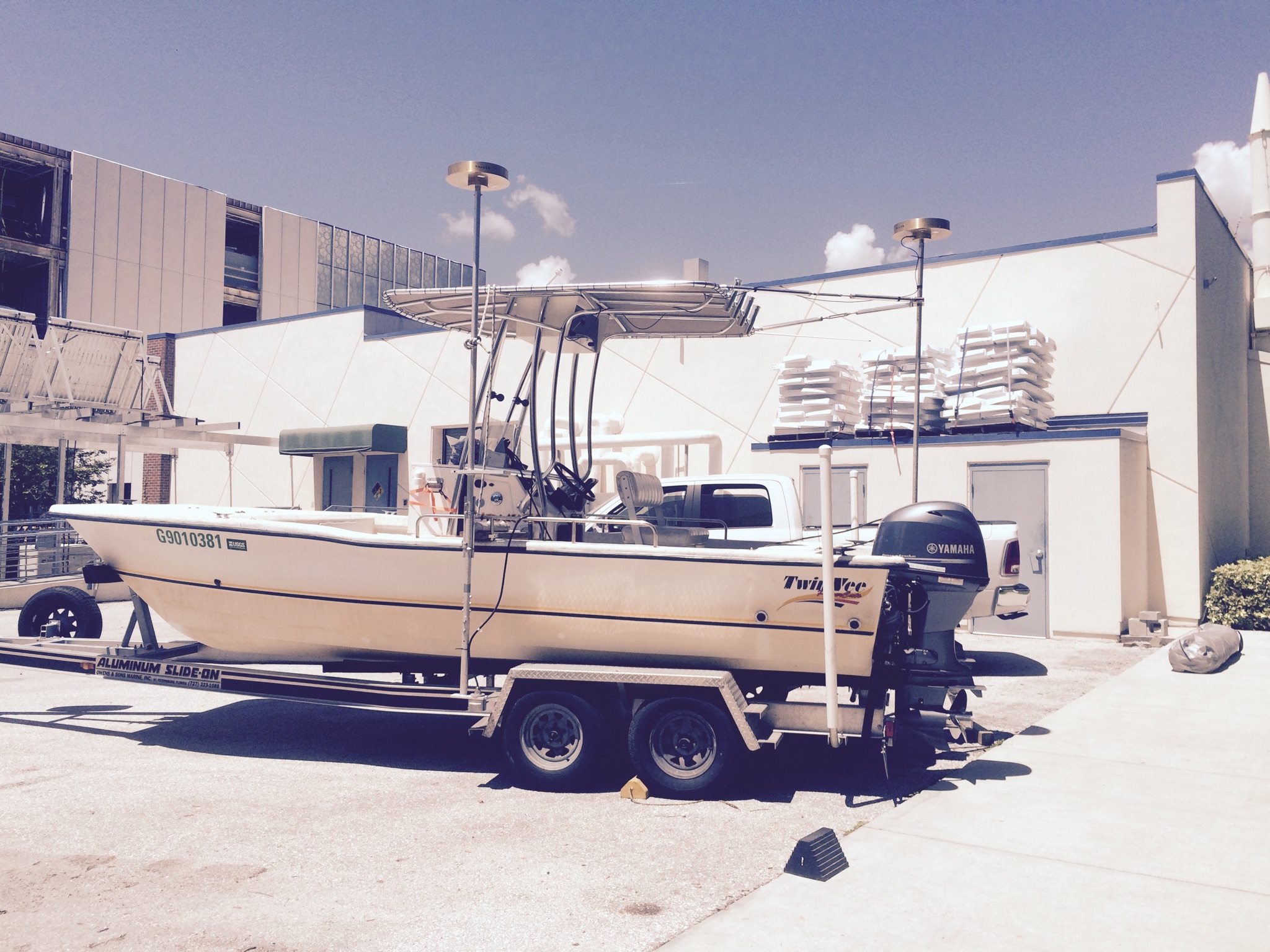
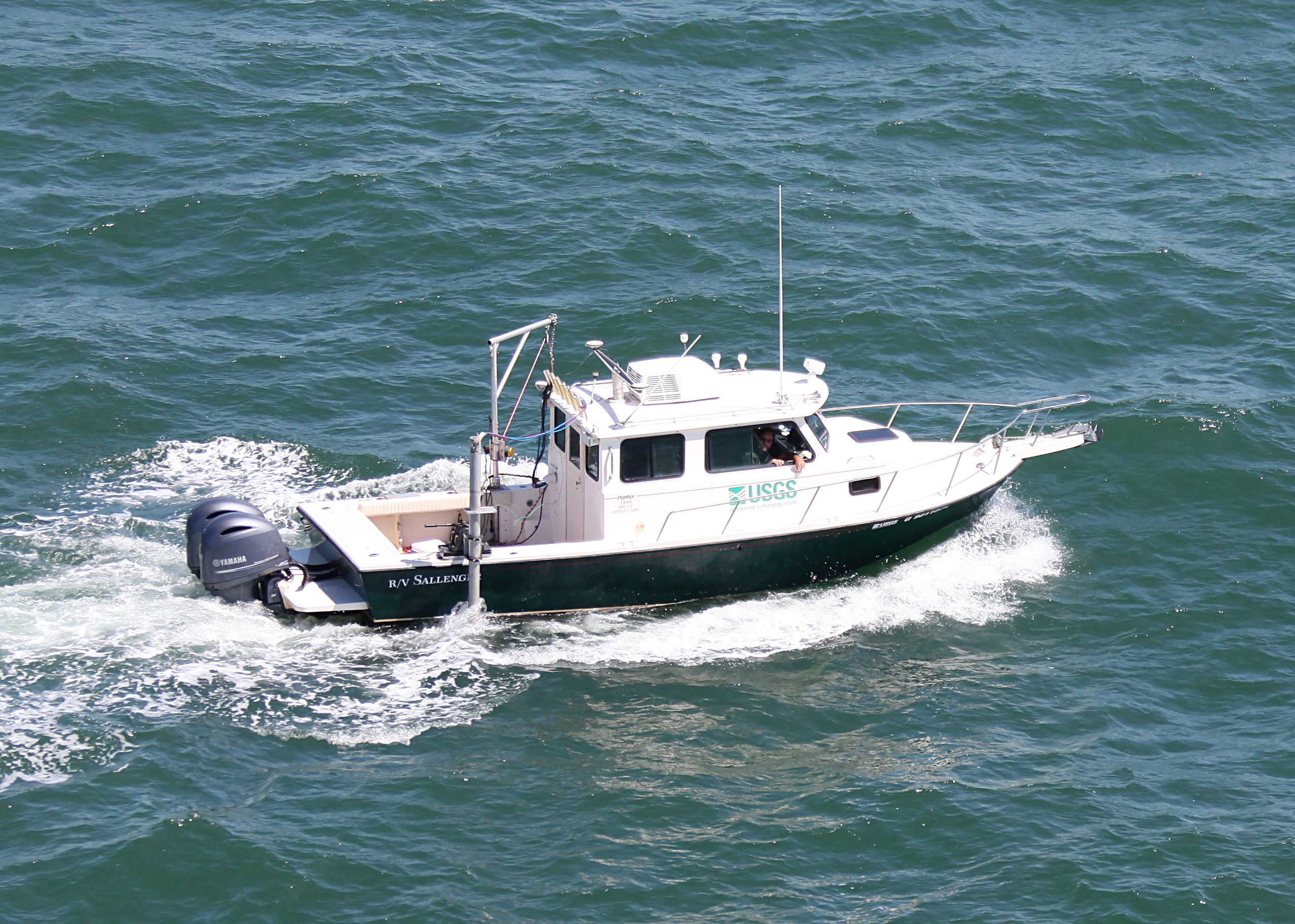
Notes: Alternate FAN info: 15BIM10 (Sallenger), 15BIM11 (Twin Vee), 15BIM12 (WVR1), 15BIM13 (WVR2)
Location:
Dauphin Island, Alabama, Gulf of Mexico
| Boundaries | |||
|---|---|---|---|
| North: 30.29249719 | South: 30.19868009 | West: -88.3445 | East: -88.06818542 |
Platform(s):
 Twin Vee (Jabba Jaw) |  Personal Water Craft (White WVR1 - Shark) |  Personal Water Craft (Blue WVR2 - Chum) |  Sallenger |
DeWitt, N.T., Stalk, C.A., Flocks, J.G., Bernier, J.C., Kelso, K.W., Fredericks, J.J., Tuten, T., 2017, Single-beam bathymetry data collected in 2015 nearshore Dauphin Island, Alabama: U.S. Geological Survey data release, https://doi.org/10.5066/F7BZ648W.
DeWitt, N.T., Stalk, C.A., Flocks, J.G., Bernier, J.C., Kelso, K.W., Fredericks, J.J., Tuten, T.M., 2018, Nearshore single-beam bathymetry data collected in 2015, Dauphin Island, Alabama: U.S. Geological Survey Data Series 1095, https://doi.org/10.3133/ds1095.
Flocks, J.G., DeWitt, N.T., Stalk, C.A., 2017, Analysis of seafloor change around Dauphin Island, Alabama, 1987-2015: U.S. Geological Survey Open-File Report 2017-1112, 26 p., https://doi.org/10.3133/ofr20171112.
Mickey, R.C., Dalyander, P.S., McCall, R., Passeri, D.L., 2020, Idealized antecedent topography sensitivity study: Initial baseline and modified profiles modeled with XBeach: U.S. Geological Survey data release, https://doi.org/10.5066/P9VD60JC.
Mickey, R.C., Dalyander, P.S., McCall, R., Passeri, D.L., 2020, Sensitivity of Storm Response to Antecedent Topography in the XBeach Model: Journal of Marine Science and Engineering, Jmse, v. 8 no. 10, 829 p., doi: 10.3390/jmse8100829.
Mickey, R.C., Godsey, E., Dalyander, P.S., Gonzalez, V., Jenkins, R.L., III, Long, J.W., Thompson, D.M., Plant, N.G., 2020, Application of decadal modeling approach to forecast barrier island evolution, Dauphin Island, Alabama: U.S. Geological Survey Open-File Report 2020-1001, 54 p., https://doi.org/10.3133/ofr20201001.
Mickey, R.C., Jenkins, R.L., Dalyander, P.S., Thompson, D.M., Plant, N.G., Long, J.W., 2020, Dauphin Island decadal forecast evolution model inputs and results : U.S. Geological Survey data release, https://doi.org/10.5066/P9PDM1OJ.
Mickey, R.C., Jenkins, R.L., Dalyander, P.S., Thompson, D.M., Plant, N.G., Long, J.W., 2020, Dauphin Island decadal hindcast model inputs and results: U.S. Geological Survey data release, https://doi.org/10.5066/P91ALL6C.
Mickey, R.C., Long, J.W., Dalyander, P.S., Jenkins, R.L., III, Thompson, D.M., Passeri, D.L., Plant, N.G., 2020, Development of a modeling framework for predicting decadal barrier island evolution: U.S. Geological Survey Open-File Report 2019-1139, https://doi.org/10.3133/ofr20191139.
Passeri, D.L., Dalyander, P.S., Long, J.W., Mickey, R.C., Jenkins, R.L., III, Thompson, D.M., Plant, N.G., Godsey, E.S., Gonzalez, V.M., 2020, The Roles of Storminess and Sea Level Rise in Decadal Barrier Island Evolution: Geophysical Research Letters, Geophys. Res. Lett., v. 47 no. 18, doi: 10.1029/2020GL089370.
Passeri, D.L., Long, J.W., Jenkins, R.L., III, Thompson, D.M., 2018, Effects of proposed navigation channel improvements on sediment transport in Mobile Harbor, Alabama: U.S. Geological Survey Open-File Report 2018-1123, https://doi.org/10.3133/ofr20181123.
Passeri, D.L., Long, J.W., Jenkins, R.L., Thompson, D.M., 2018, Mobile Harbor navigation channel Delft3D model inputs and results: U.S. Geological Survey data release, https://doi.org/10.5066/P9SS1DJW.
| Survey Equipment | Survey Info | Data Type(s) | Data Collected |
|---|---|---|---|
| Ashtech ProFlex 500 GNSS Receiver | --- | Benchmarks Navigation | |
| Ashtech ProFlex 800 GNSS Receiver | --- | Benchmarks Navigation | Dauphin_Island_2015_SBB_ITRF00_50_DEM (Bathymetry DEM, 50-m cell size in ITRF00.) Dauphin_Island_2015_SBB_NAD83_tracklines (Single-beam trackline shapefile in NAD83.) Dauphin_Island_2015_SBB_NAD83_MLLW_50_DEM (Bathymetry DEM, 50-m cell size, in NAD83 and MLLW.) Dauphin_Island_2015_SBB_ITRF00_xyz (The single-beam soundings (xyz) in ITRF00 and ellipsoid height.) Dauphin_Island_2015_SBB_NAD83_NAVD88_GEOID12A_50_DEM (Bathymetry DEM, 50-m cell size, in NAD83 and NAVD88 with respect to the GEOID12A model.) Dauphin_Island_2015_SBB_NAD83_MLLW_xyz (The single-beam soundings (xyz) in NAD83 MLLW.) Dauphin_Island_2015_SBB_ITRF00_tracklines (Single-beam trackline shapefile in ITRF00.) Dauphin_Island_2015_SBB_ NAD83_NAVD88_GEOID12A _xyz (The single-beam soundings (xyz) in NAD83 and NAVD88 (orthometric height) with respect to the GEOID12A model. ) |
| Choke Ring Antenna | --- | Benchmarks Navigation | |
| Bubble Pulser | --- | Bubble Gun | |
| Bubble Pulser Hydrophone Streamer Cable | --- | Bubble Gun | |
| ODOM-Echotrac CV-100 | --- | Single Beam | |
| TSS DMS-05 Motion Sensor | --- | Interferometric Single Beam |