Other ID: 15BIM14
Status: Completed
Organization(s): USGS, St. Petersburg Coastal and Marine Science Center
Funding Program(s): Alabama Barrier Island Restoration Feasibility Study - Bathymetry and Geophysical Surveys (GR.19.MN00.G1V21.00)
Principal Investigator(s): James Flocks, Stanley Locker
Affiliate Investigator(s):
Information Specialist(s): Arnell Forde
Data Type(s): Location-Elevation: Navigation, Seismics: Bubble Gun, Seismics: Sub Bottom Profiler, Sonar: Multibeam, Sonar: Sidescan
Scientific Purpose/Goals: To collect geophysical data for NFWF RESTORE Dauphin Island feasibility study.
Vehicle(s): Chevy Suburban Silver
Start Port/Location: Dauphin Island, AL
End Port/Location: Dauphin Island, AL
Start Date: 2015-09-16
End Date: 2015-09-23
Equipment Used: Applanix POS-MV DGPS/IMU, Bubble Pulser, Bubble Pulser Hydrophone Streamer, SeaBat 8125 (SC), Chirp 512i, Klein Side Scan Sonar
Information to be Derived: Water depth/seafloor elevation, subbottom profiles
Summary of Activity and Data Gathered: Collected 118 lines of 512i chirp data and 19 lines of bubble pulser data. USACE collected and processed all the multibeam data.
Staff: James Flocks, Stanley Locker
Affiliate Staff:
Notes:
Location:
Dauphin Island, Alabama, Gulf of America (Gulf of Mexico)
| Boundaries | |||
|---|---|---|---|
| North: 30.29249719 | South: 30.19868009 | West: -88.3445 | East: -88.06818542 |
Platform(s):
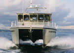
 Irvington |
Forde, A.S., Flocks, J.G., Locker, S.D., 2022, Archive of Chirp Subbottom Profile Data Collected in 2015 From Dauphin Island, Alabama: U.S. Geological Survey data release, https://doi.org/10.5066/P9YTIG6G.
| Survey Equipment | Survey Info | Data Type(s) | Data Collected |
|---|---|---|---|
| Applanix POS-MV DGPS/IMU | --- | Navigation | 2015-330-FA_nav.zip (Navigation data for the entire survey, 1000-shot-interval locations, and start of line locations ) |
| Bubble Pulser | --- | Bubble Gun | |
| Bubble Pulser Hydrophone Streamer | --- | Bubble Gun | |
| SeaBat 8125 (SC) | --- | Multibeam | |
| Chirp 512i | --- | Sub Bottom Profiler | 2015-330-FA_segy.zip (Digital chirp subbottom trace data) 2015-330-FA_seisimag.zip (Processed subbottom profile images ) 2015-330-FA_gis.zip (Subbottom profile data location map, geospatial files, and images) |
| Klein Side Scan Sonar | --- | Sidescan |