AKA: none
Other ID: none
Status: Completed
Organization(s): USGS, Pacific Coastal and Marine Science Center
Funding Program(s): Coastal and marine earthquake, tsunami, and landslide active margin field studies (ZP00EQV)
Principal Investigator(s): Daniel Brothers
Affiliate Investigator(s): Peter Haeussler (Alaska Science Center)
Information Specialist(s): Peter Dartnell
Data Type(s): Location-Elevation: Navigation, Seismics: Multichannel, Seismics: Sparker, Sonar: Multibeam
Scientific Purpose/Goals: To map the offshore extension of the Queen Charlotte-Fairweather Fault. The fault has produced several significant earthquakes during the last 150 years, yet little to no information exists along most of its length due to its location offshore. We aim to image the fault structure, mode of deformation and constrain its late Holocene slip rate for the northernmost segment.
Vehicle(s): None
Start Port/Location: Cordova, AK
End Port/Location: Cordova, AK
Start Date: 2015-04-28
End Date: 2015-05-24
Equipment Used: Mini-sparker, CodaOctopus F180, Other, Mini sparker, Reson 7111
Information to be Derived: seabed morphology, character and substrate architecture
Summary of Activity and Data Gathered: Files on FAD 6/29/2015 GeometricGeoEel - raw seismic reflection profiles, see Danny Brothers GIS - GIS files processed at sea, see Pete Dartnell Reson7111 - shipboard PDS2000 and Caris projects, see Pete Dartnell SVP - shipboard SVP files, see Pete Dartnell F180 - shipboard MCOM files
Staff: Jackson Currie, Gerry Hatcher, Robert Wyland
Affiliate Staff:
Notes:
Location:
Southeastern Alaska, offshore Glacier Bay National Park
| Boundaries | |||
|---|---|---|---|
| North: 58.60833366 | South: 57.25826466 | West: -138.274 | East: -134.95556641 |
Platform(s):
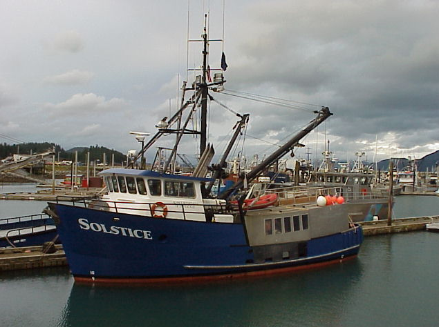 Solstice |
Balster-Gee, A.F., Brothers, D.S., Haeussler, P.J., Dartnell, P., Hart, P.E., Wyland, R., and Hatcher, G.A., 2023, Multichannel minisparker seismicreflection data collected offshore Glacier Bay National Park during USGS field activity 2015-629-FA: U.S. Geological Survey data release, https://doi.org/10.5066/P97Q990F.
Dartnell, P., Brothers, D.S., and Haeussler, P.J., 2022, Multibeam bathymetry and acoustic-backscatter data collected in 2015 near Cross Sound, southeast Alaska, during field activity 2015-629-FA: U.S. Geological Survey data release, https://doi.org/10.5066/F7JH3KG6.
Dartnell, P., Brothers, D.S., Haeussler, P.J., Hatcher, G.A., Wyland, R., 2025, Multibeam line files from Cross Sound, Alaska collected during USGS field activity 2015-629-FA: U.S. Geological Survey data release, https://doi.org/10.5066/P1ED3GXB.
Andrews, B.D., Brothers, D.S., Dartnell, P., Barrie, J.V., Haeussler, P.J., Green, K.M., Greene, H.G., Miller, N.C., Kluesner, J.W., and ten Brink, U.S., 2022, Systematic mapping of the ocean-continent transform plate boundary of the Queen Charlotte fault system, southeastern Alaska and western British Columbia—A preliminary bathymetric terrain model: U.S. Geological Survey Open-File Report 2022–1085, 2 sheets, 7-p. pamphlet, https://doi.org/10.3133/ofr20221085.
Andrews, B.D., Brothers, D.S., Dartnell, P., and Barrie, J.V., 2022, A bathymetric terrain model of multibeam sonar data collected between 2005 and 2018 along the Queen Charlotte Fault System in the Eastern Gulf of Alaska from Cross Sound, Alaska to Queen Charlotte Sound, Canada: U.S. Geological Survey data release, https://doi.org/10.5066/P9YGDHIQ.
| Survey Equipment | Survey Info | Data Type(s) | Data Collected |
|---|---|---|---|
| Mini-sparker | --- | Sparker | Multichannel minisparker seismic-reflection data collected offshore Glacier Bay National Park during USGS field activity 2015-629-FA (Multichannel seismic reflection data were collected by the U.S. Geological Survey in May of 2015 outside of Palma Bay, Alaska. Seismic data were acquired coincidentally with high resolution bathymetry.) |
| CodaOctopus F180 | --- | Navigation | Navigation tracklines (These metadata describe navigation tracklines from a 2015 multibeam echosounder survey near Cross Sound, southeast Alaska. The trackline data are provided as a GIS shapefile.) |
| Other | --- | --- | --- |
| Mini sparker | --- | Sparker | |
| Reson 7111 | --- | Multibeam | Multibeam acoustic-backscatter data (These metadata describe acoustic-backscatter collected during a 2015 multibeam echosounder survey near Cross Sound, southeast Alaska. The acoustic-backscatter data are provided as a GeoTIFF.) Multibeam bathymetry data (These metadata describe bathymetry collected during a 2015 multibeam echosounder survey near Cross Sound, southeast Alaska. The bathymetry data are published here as a 32-bit GeoTIFF image.) Multibeam line files from Cross Sound, Alaska collected during USGS field activity 2015-629-FA (In 2015 the U.S. Geological Survey (USGS), Pacific Coastal and Marine Science Center (PCMSC) in cooperation with the Alaska Department of Fish and Game (ADFG) collected bathymetry and acoustic backscatter data offshore Cross Sound in southeast Alaska using an Reson 7111 multibeam echosounder mounded to the ADFG R/V Solstice. The survey was conducted to map the offshore expression of the Queen Charlotte fault system that runs for approximately 500 kilometers off the coast of southeast Alaska and British Columbia. This data release provides the processed multibeam line files in GSF format.) |
