AKA: none
Other ID: none
Status: Cancelled
Organization(s): USGS, Pacific Coastal and Marine Science Center
Funding Program(s): Sediment Transport in Coastal Environments (ZP00FDB)
Principal Investigator(s): Jessica Lacy
Affiliate Investigator(s): Jan Thompson USGS Jon Burau USGS Tara Morgan USGS
Information Specialist(s): Jessica Lacy
Data Type(s): Environmental Data: CTD, Environmental Data: Turbidity, Environmental Data: Wave, Location-Elevation: Benchmarks, Location-Elevation: Navigation, Location-Elevation: Profiles, Location-Elevation: Transects, Sampling: Geology, Sonar: Single Beam, Time Series: Mooring (physical oceanography)
Scientific Purpose/Goals: To improve the scientific basis for shallow water habitat restoration to support fisheries in the San Francisco Bay Delta, in collaboration with scientists from the NRP and CA Water Science Center.
Vehicle(s): MarFac; Chevy Suburban - gray; 7 pass; G62-2874L
Start Port/Location: Rio Vista, CA
End Port/Location: Rio Vista, CA
Start Date: 2015-05-22
End Date: 2016-07-31
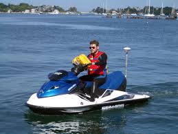
Equipment Used: Other, Trimble R7 GPS (AS), Waverunners, Van Veen
Information to be Derived: Time series of suspended sediment concentration, tidal stage, and wave attributes.
Summary of Activity and Data Gathered: cancelled because FAN already exists
Staff: Timothy Elfers, Cordell Johnson, Alexander Snyder, Andrew Stevens
Affiliate Staff:
Notes: 1 day for topography and bathy recon; another day or two finish topo and bathy in June.
Entries for this field activity are based on entries from Field Activity 2014-655-FA; added topo and bathy equipment
Time-series instruments to be deployed this summer
Tim Elfers initiated this FAN for Jessie Lacy in her absence
Location:
San Francisco Bay Delta, Little Holland Tract, California
| Boundaries | |||
|---|---|---|---|
| North: 38.34440275 | South: 38.22842333 | West: -121.729 | East: -121.63231728 |
Platform(s):
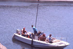
 Fast Eddy (SC) |  Waverunner 1 (SC) |  Waverunner 2 (SC) |
| Survey Equipment | Survey Info | Data Type(s) | Data Collected |
|---|---|---|---|
| Other | --- | --- | --- |
| Trimble R7 GPS (AS) | --- | Benchmarks Navigation Profiles Transects | |
| Waverunners | --- | Navigation Single Beam | |
| Van Veen | --- | Biology Geology |