Other ID: none
Status: Completed
Organization(s): USGS, Woods Hole Coastal and Marine Science Center
Funding Program(s): Barrier Evolution (MN00F1F)
Principal Investigator(s): Christopher Sherwood
Affiliate Investigator(s):
Information Specialist(s): Ellyn Montgomery
Data Type(s): Location-Elevation: Navigation, Sonar: Sidescan, Sonar: Single Beam
Scientific Purpose/Goals: Jetyak operations to map Sandwich Town Beach nearshore
Vehicle(s):
Start Port/Location: Sandwich, MA
End Port/Location: Sandwich, MA
Start Date: 2016-06-06
End Date: 2016-06-08
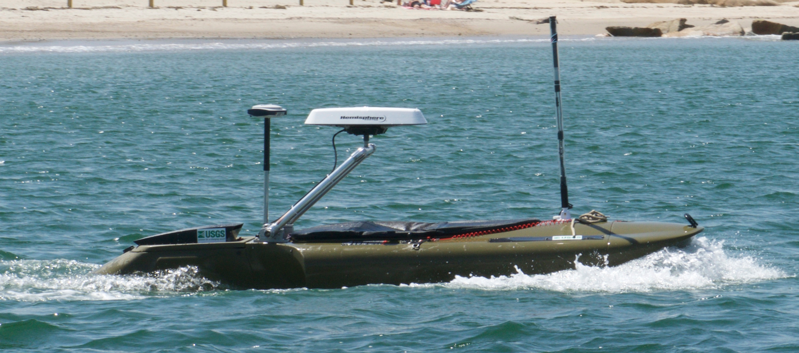
Equipment Used: Humminbird 898c HD SI Combo (Jetyak), Spectra Precision SP80
Information to be Derived: bathymetry, backscatter, navigation
Summary of Activity and Data Gathered: Jetyak bathymetric/backscatter survey of the nearshore was completed
Staff: Jonathan Borden, Sandra Brosnahan, Barry Irwin, Ann Luppino, Marinna Martini, Daniel Nowacki
Affiliate Staff:
Notes: The RTK-GPS system we are using is a Spectra SP80. We are also using a Hemisphere GPS heading system installed on the jetyak.
Entries for this field activity are based on entries from Field Activity 2016-006-FA.
Platform used for sidescan/bathymetry/navigation is the USGS modified kayak named the jetyak.
Location:
Sandwich Town Neck Beach, Cape Cod Bay, Massachusetts, United States, Atlantic Ocean
| Boundaries | |||
|---|---|---|---|
| North: 41.77731442 | South: 41.75964597 | West: -70.50674438 | East: -70.46913148 |
Platform(s):
 Jetyak-WHCMSC |
Danforth, W.W. Sherwood, C.R., Martini, M.A., Borden, J., and Brosnahan, S.M., 2018, Sidescan sonar, single beam bathymetry, and navigation collected offshore of Sandwich Beach in 2016, U.S. Geological Field Activity 2016-030-FA: U.S. Geological Survey data release, https://doi.org/10.5066/P9TJIM2M.
| Survey Equipment | Survey Info | Data Type(s) | Data Collected |
|---|---|---|---|
| Humminbird 898c HD SI Combo (Jetyak) | A Humminbird 898c HD SI Combo GPS/Fish Finder remote sensing instrument was used to collect sidescan, single beam bathymetry, and DGPS navigation. The equipment is mounted in the hull of the jetyak | Sidescan Single Beam Navigation | 2016-030-FA_backscatter (1-meter resolution image mosaic representing sidescan sonar data collected by the U.S. Geological Survey during field activity 2016-030-FA offshore Sandwich Beach, MA in June 2016 (24-bit GeoTIFF, UTM Zone 19N, NAD83-HARN)) 2016-030-FA_navigation (Comma separated value (CSV) text files of navigation and elevation data collected by the U.S. Geological Survey during field activity 2016-030-FA offshore Sandwich Beach, MA in June 2016) 2016-030-FA_bathymetry (4-meter resolution bathymetric grid representing single beam data collected by the U.S. Geological Survey during field activity 2016-030-FA offshore Sandwich Beach, MA in June 2016 (32-bit GeoTIFF, UTM Zone 19N, NAD83-HARN)) |
| Spectra Precision SP80 | Two receivers were used to collect satellite range and position data, one located on Sandwich Beach (base), and one located on the jetyak (rover). | Navigation | 2016-030-FA_orthometric (Comma separated value (CSV) text file of post-processed kinematic (PPK) data calculated from raw data logged on two Spectra Precision SP80 GNSS receivers during survey 2016-030-FA conducted offshore Sandwich Beach, MA by the U.S. Geological Survey in 2016) |
