Other ID: none
Status: Pending
Organization(s): USGS, Pacific Coastal and Marine Science Center
Funding Program(s): Other (Other)
Principal Investigator(s): Other
Affiliate Investigator(s): Jason Chaytor
Information Specialist(s): Other
Data Type(s): Time Series: Mooring (physical oceanography)
Scientific Purpose/Goals: Recover Sediment Trap moorings in VI Basin
Vehicle(s):
Start Port/Location: Frederiksted, St. Croix, USVI
End Port/Location: Miami, FL
Start Date: 2016-06-16
End Date: 2016-06-28
Equipment Used: Sensors - other mooring
Information to be Derived: Sediment,CT and ADCP
Summary of Activity and Data Gathered:
Staff: Jonathan Borden, Sandra Brosnahan
Affiliate Staff:
Notes:
Location:
USVI
| Boundaries | |||
|---|---|---|---|
| North: 18.23766649 | South: 17.88363222 | West: -65.0267 | East: -64.56952243 |
Platform(s):
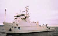 Nancy Foster |
| Survey Equipment | Survey Info | Data Type(s) | Data Collected |
|---|---|---|---|
| Sensors - other mooring | --- | CTD Meteorology Temperature Mooring (physical oceanography) |
