Other ID: none
Status: Completed
Organization(s): USGS, Woods Hole Coastal and Marine Science Center
Funding Program(s): Barrier Evolution (MN00F1F)
Principal Investigator(s): Seth Ackerman, Christopher Sherwood
Affiliate Investigator(s):
Information Specialist(s): Seth Ackerman
Data Type(s): Imagery: Photo, Imagery: Video, Location-Elevation: Navigation, Sampling: Geology
Scientific Purpose/Goals: surfical sea floor mapping offshore of Town Neck Beach (MA)
Vehicle(s):
Start Port/Location: Sandwich, MA
End Port/Location: Sandwich, MA
Start Date: 2016-07-15
End Date: 2016-07-15
Equipment Used: WAAS/DGPS, SeaViewer 6000 HD Sea-Drop video camera, SeaBOSS, GoPro camera
Information to be Derived: sea floor sediment samples, sea floor video and photographs
Summary of Activity and Data Gathered: seaboss surveys were conducted to evaluate the seafloor composition of the nearshore region of town neck beach
Staff: Seth Ackerman, Dann Blackwood, Jane Denny, Barry Irwin
Affiliate Staff:
Notes: Entries for this field activity are based on entries from Field Activity 2016-017-FA
Also staffed by Abigail Ball
Location:
Town Neck Beach, Sandwich, MA
| Boundaries | |||
|---|---|---|---|
| North: 41.82323848 | South: 41.72449187 | West: -70.5377 | East: -70.40252686 |
Platform(s):
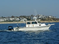
 Rafael |
Ackerman S.D., Foster D.S., Danforth W.W., and Huntley, E.C., 2019, High-resolution geophysical and sampling data collected off Town Neck Beach in Sandwich, Massachusetts, 2016: U.S. Geological Survey data release, https://doi.org/10.5066/P9HZHXXV.
| Survey Equipment | Survey Info | Data Type(s) | Data Collected |
|---|---|---|---|
| WAAS/DGPS | --- | Navigation | |
| SeaViewer 6000 HD Sea-Drop video camera | Mounted on the SEABOSS system. | Video | 2016-037-FA_videos (Location of bottom video tracklines along with videos collected in July 2016 by the U.S. Geological Survey off Town Neck Beach, Sandwich, Massachusetts, during field activity 2016-037-FA (MP4 video files and polyline shapefile)) |
| SeaBOSS | The MiniSEABOSS (SEABed Observation and Sampling System) was used to collect sediment samples with a modified Van Veen sampler and video images of the seabed with GoPro cameras mounted on the frame. | Surveys (biological) Experiments (biological) Species ID Photo Video Geology Biology | 2016-037-FA_samples (Grain-size analysis of sediment samples collected in July 2016 by the U.S. Geological Survey off Town Neck Beach, Sandwich in Massachusetts, during field activity 2016-037-FA (CSV file and simplified shapefile)) |
| GoPro camera | Mounted on the SEABOSS system. | Photo Video | 2016-037-FA_photos (Location of bottom photographs along with images collected in July 2016 by the U.S. Geological Survey off Town Neck Beach, Sandwich, Massachusetts, during field activity 2016-037-FA (JPEG images, point shapefile, and CSV file)) |