Other ID: none
Status: Completed
Organization(s): USGS, Woods Hole Coastal and Marine Science Center, USGS, Wetland and Aquatic Research Center
Funding Program(s):
Principal Investigator(s): Jason Chaytor
Affiliate Investigator(s): Amanda Demopoulos
Information Specialist(s): Jason Chaytor
Data Type(s): Biological Field Study: Surveys (biological), Environmental Data: CTD, Location-Elevation: Navigation, Sampling: Geology
Scientific Purpose/Goals: Deep sea corals and benthic habitats
Vehicle(s):
Start Port/Location: Quonset Point, RI
End Port/Location: Quonset Point, RI
Start Date: 2016-08-24
End Date: 2016-09-03
Equipment Used: Other, DGPS, monocorer, SBE 19plus V2 SeaCAT Profiler CTD
Information to be Derived: samples (chaytor) - grain size, composition
Summary of Activity and Data Gathered: Sediment samples (sub-sampled from push cores), CTD data
Staff: Other
Affiliate Staff:
Notes: Samples from Cape Fear Landslide and Hatteras canyon send to WHCMSC. Geological samples were collected using a monocorer attached to the base of the CTD.
Location:
Keller Canyon to Cape Fear Slide
| Boundaries | |||
|---|---|---|---|
| North: 35.61041789 | South: 30.85567461 | West: -76.35498047 | East: -71.05908203 |
Platform(s):
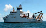 Pisces |
| Survey Equipment | Survey Info | Data Type(s) | Data Collected |
|---|---|---|---|
| Other | --- | --- | --- |
| DGPS | --- | Navigation | |
| monocorer | --- | Biology Geology | |
| SBE 19plus V2 SeaCAT Profiler CTD | --- | CTD Fluorescence Turbidity |
