Other ID: 16BIM01, 16BIM02, 16BIM03
Status: Completed
Organization(s): USGS, St. Petersburg Coastal and Marine Science Center
Funding Program(s): Barrier Island Evolution Research - BIER Geophysics (GX.16.MN00.F1F40.00)
Principal Investigator(s): Jennifer Miselis
Affiliate Investigator(s):
Information Specialist(s): Nancy DeWitt, Kyle Kelso, Billy Reynolds, Chelsea Stalk, Anastasios Stathakopoulos
Data Type(s): Location-Elevation: Benchmarks, Location-Elevation: LIDAR, Location-Elevation: Navigation, Seismics: Sub Bottom Profiler, Sonar: Interferometric, Sonar: Single Beam
Scientific Purpose/Goals: 1) Measure bathymetric change and borrow site deposition on the N. Chandeleurs island platform and 2) Provide elevation control for topo-bathymetric lidar survey
Vehicle(s): Chevy Suburban Silver, Ford F-350 Dually Silver (GSA)
Start Port/Location: Biloxi, MS
End Port/Location: Biloxi, MS
Start Date: 2016-06-10
End Date: 2016-06-19
Equipment Used: Ashtech ProFlex 500 GNSS Receiver, Ashtech ProFlex 800 GNSS Receiver, Ashtech Z-Xtreme DGPS, Choke Ring Antenna, Light Detection and Ranging (Lidar), Collapsible Tripod, F190 DGPS/IMU, Garmin GPS, Other, Chirp 424, ODOM-Echotrac CV-100, Interferometric Bathymetry System
Information to be Derived: Topographic and bathymetric elevations, deposit stratigraphy, and verification of lidar data
Summary of Activity and Data Gathered: 16BIM01: Collected 82 subbottom profiles, 48 interferometric swath bathymetry lines and 34 SVP casts 16BIM03: Static ground control points (includes bare earth, vegetation, and ground control) (62), CTD profiles (9), Secchi disk readings (9)
Staff: Nancy DeWitt, Arnell Forde, Kyle Kelso, Billy Reynolds, Chelsea Stalk
Affiliate Staff:
Notes: Subfans:
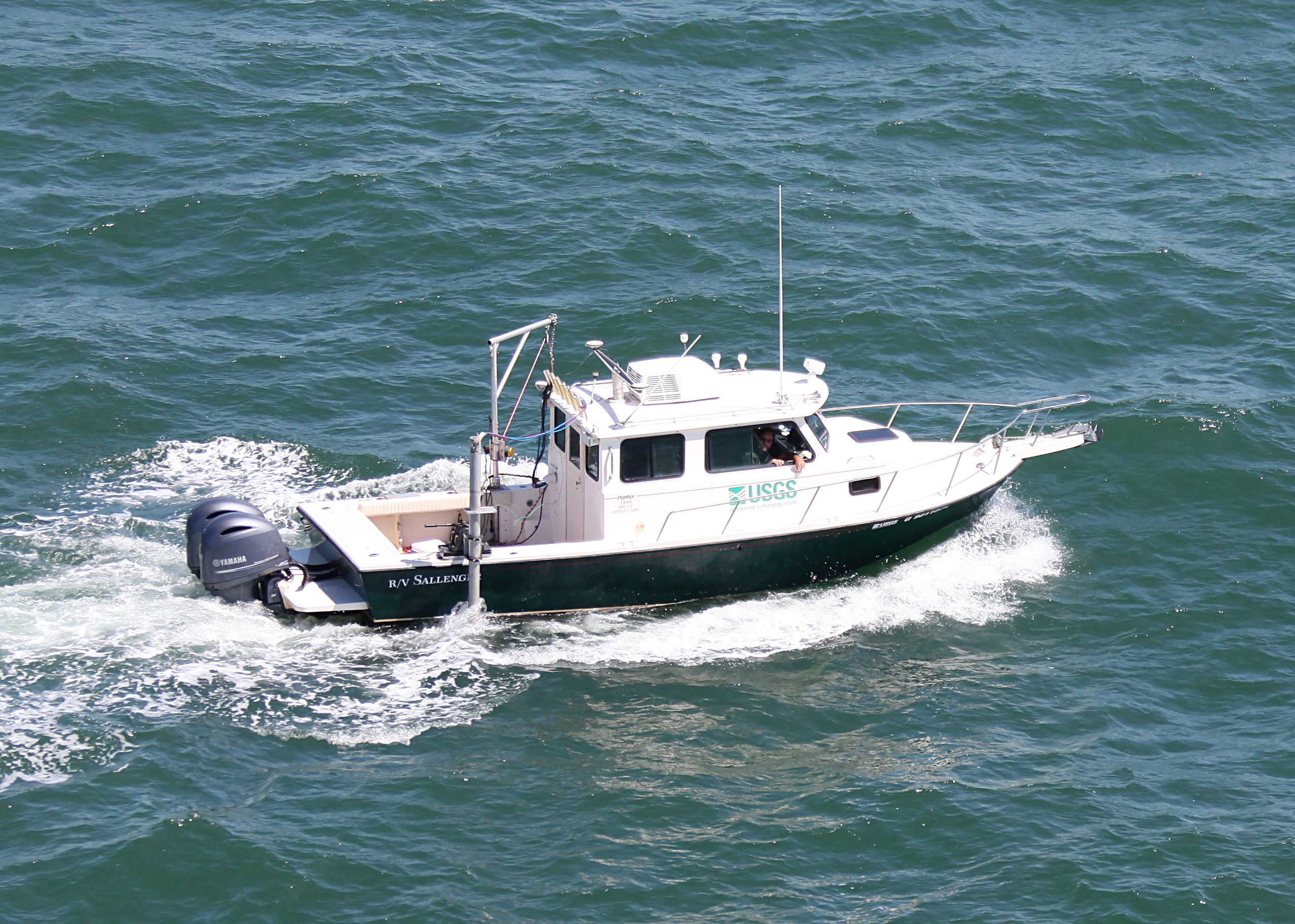
16BIM01 = R/V Sallenger
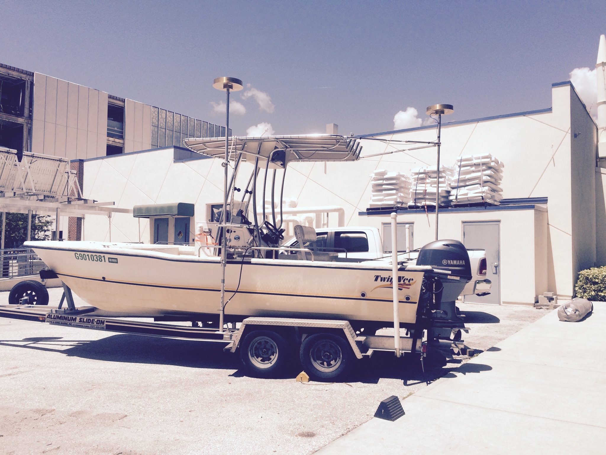
16BIM02 = R/V Jabba Jaw
16BIM03 = Lidar ground support on foot
Location:
Chandeleur Islands, LA, Gulf of America (Gulf of Mexico)
| Boundaries | |||
|---|---|---|---|
| North: 30.05356335 | South: 29.67091617 | West: -89.1376 | East: -88.51818848 |
Platform(s):
 Sallenger |  22-ft Twin Vee (R/V G. Hill) |
Farmer, A.S., Fredericks, J.J., Miselis, J.L., Buster, N.A., DeWitt, N.T., Kelso, K.W., Stalk, C.A., Reynolds, B.J., 2018, Coastal bathymetry data collected in 2016 from the Chandeleur Islands, Louisiana: U.S. Geological Survey data release, https://doi.org/10.5066/P993MBJK.
Forde, A.S., DeWitt, N.T., Miselis, J.L., 2018, Archive of chirp subbottom profile data collected in 2016 from the northern Chandeleur Islands, Louisiana: U.S. Geological Survey data release, https://doi.org/10.5066/P9NFK0K4.
| Survey Equipment | Survey Info | Data Type(s) | Data Collected |
|---|---|---|---|
| Ashtech ProFlex 500 GNSS Receiver | --- | Benchmarks Navigation | |
| Ashtech ProFlex 800 GNSS Receiver | --- | Benchmarks Navigation | |
| Ashtech Z-Xtreme DGPS | --- | Benchmarks Navigation | |
| Choke Ring Antenna | --- | Benchmarks Navigation | |
| Light Detection and Ranging (Lidar) | --- | LIDAR | |
| Collapsible Tripod | --- | Benchmarks Navigation Profiles Transects | |
| F190 DGPS/IMU | --- | Navigation | |
| Garmin GPS | --- | Navigation | |
| Other | --- | --- | --- |
| Chirp 424 | --- | Sub Bottom Profiler | 2016-335-FA_nav.zip (Navigation data ) 2016-335-FA_segy.zip (Unprocessed digital chirp subbottom trace data) 2016-335-FA_seisimag.zip (Processed subbottom profile images (.gif)) 2016-335-FA_arc.zip (Survey trackline locations) |
| ODOM-Echotrac CV-100 | --- | Single Beam | Chandeleur_Islands_2016_SBB_and_IFB_ NAD83_NAVD88_GEOID09_50_DEM.zip (The SBB and IFB soundings in NAD83 and NAVD88 (ellipsoid height) with respect to the GEOID09 model (.tif)) Chandeleur_Islands_2016_SBB_NAD83_tracklines.zip (Single-beam trackline shapefile in NAD83 (.shp)) Chandeleur_Islands_2016_SBB_ITRF08_xyz.zip (The single-beam soundings (xyz) in ITRF08 (.txt)) Chandeleur_Islands_2016_SBB_ NAD83_NAVD88_GEOID09_xyz.zip (The single-beam soundings (xyz) in NAD83 and NAVD88 (ellipsoid height) with respect to the GEOID09 model (.txt)) Chandeleur_Islands_2016_SBB_ITRF08_tracklines.zip (Single-beam trackline shapefile in ITRF08 (.shp)) |
| Interferometric Bathymetry System | --- | Interferometric | Chandeleur_Islands_2016_IFB_ NAD83_NAVD88_GEOID09_xyz.zip (The IFB soundings (xyz) in NAD83 and NAVD88 (ellipsoid height) with respect to the GEOID09 model (.txt)) Chandeleur_Islands_2016_IFB_ITRF08_xyz.zip (The IFB soundings (xyz) in ITRF08 (.txt)) Chandeleur_Islands_2016_IFB_ITRF08_tracklines.zip (IFB trackline shapefile in ITRF08 (.shp)) Chandeleur_Islands_2016_SBB_and_IFB_ NAD83_NAVD88_GEOID09_50_DEM.zip (The SBB and IFB soundings in NAD83 and NAVD88 (ellipsoid height) with respect to the GEOID09 model (.tif)) Chandeleur_Islands_2016_IFB_NAD83_tracklines.zip (IFB trackline shapefile in NAD83 (.shp)) |