Other ID: none
Status: Cancelled
Organization(s): USGS, St. Petersburg Coastal and Marine Science Center
Funding Program(s): Barrier Island Comprehensive Monitoring - BICM (GR.20.MN00.FT954.00)
Principal Investigator(s): James Flocks
Affiliate Investigator(s):
Information Specialist(s): Julie Bernier, Nancy DeWitt, Chelsea Stalk
Data Type(s): Location-Elevation: Benchmarks, Location-Elevation: Navigation, Seismics: Sub Bottom Profiler, Sonar: Single Beam, Sonar: Sound Velocity
Scientific Purpose/Goals: Collect single beam bathymetry along the Louisiana Chenier Plain coastline from Marsh Island to Sabine Pass, TX
Vehicle(s): Chevy Suburban Silver, Ford F-350 Dually - Silver (GSA), White Dodge Pickup - White
Start Port/Location: Abbeville, LA
End Port/Location: Rockefeller NWR, LA
Start Date: 2016-09-12
End Date: 2016-09-27
Equipment Used: Ashtech ProFlex 500 GNSS Receiver, Ashtech ProFlex 800 GNSS Receiver, Choke Ring Antenna, Other, Collapsible Tripod, Other, Chirp 424, ODOM-Echotrac CV-100, Castaway-CTD, Valeport Mini Sound Velocity Probe, Valeport SVP
Information to be Derived: Single beam bathymetry and sub-bottom profiles.
Summary of Activity and Data Gathered: Fieldwork postponed until summer 2017
Staff: Julie Bernier, Nancy DeWitt, Andrew Farmer, James Flocks, Joseph Fredericks, Chelsea Stalk, Thomas Tuten
Affiliate Staff:
Notes: This will be leg 1 of 2 trips to survey the full extent:
Sub FANs:
16BIM07 = R/V Sallenger - SBB + chirp
16BIM08 = R/V TwinVee - SBB
16BIM09 = R/V Shark (White = WVR1) - SBB
16BIM10 = R/V Chum (Blue = WVR2) - SBB
Entries for this field activity are modified from entries from Field Activity 2015-320-FA.
Location:
Leg 1: Eastern Chenier Plain and Marsh Island
| Boundaries | |||
|---|---|---|---|
| North: 29.7588636 | South: 29.44806262 | West: -93.8575 | East: -91.74951088 |
Platform(s):
 Twin Vee (Jabba Jaw) |  Personal Water Craft (Blue WVR2 - Chum) | 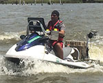 Personal Water Craft (White WVR1 - Shark) |  Sallenger |
| Survey Equipment | Survey Info | Data Type(s) | Data Collected |
|---|---|---|---|
| Ashtech ProFlex 500 GNSS Receiver | --- | Benchmarks Navigation | |
| Ashtech ProFlex 800 GNSS Receiver | --- | Benchmarks Navigation | |
| Choke Ring Antenna | --- | Benchmarks Navigation | |
| Other | --- | --- | --- |
| Collapsible Tripod | --- | Benchmarks Navigation Profiles Transects | |
| Other | --- | --- | --- |
| Chirp 424 | --- | Sub Bottom Profiler | |
| ODOM-Echotrac CV-100 | --- | Single Beam | |
| Castaway-CTD | --- | Sound Velocity | |
| Valeport Mini Sound Velocity Probe | --- | Sound Velocity | |
| Valeport SVP | --- | Sound Velocity |
