Other ID: none
Status: Completed
Organization(s): USGS, St. Petersburg Coastal and Marine Science Center
Funding Program(s): St. Petersburg Science Center Marine Operations (GX.24.MN00.0AZMO.00)
Principal Investigator(s): Christopher Reich
Affiliate Investigator(s):
Information Specialist(s): Nancy DeWitt, Kyle Kelso
Data Type(s): Location-Elevation: Benchmarks, Location-Elevation: Navigation, Sonar: Single Beam
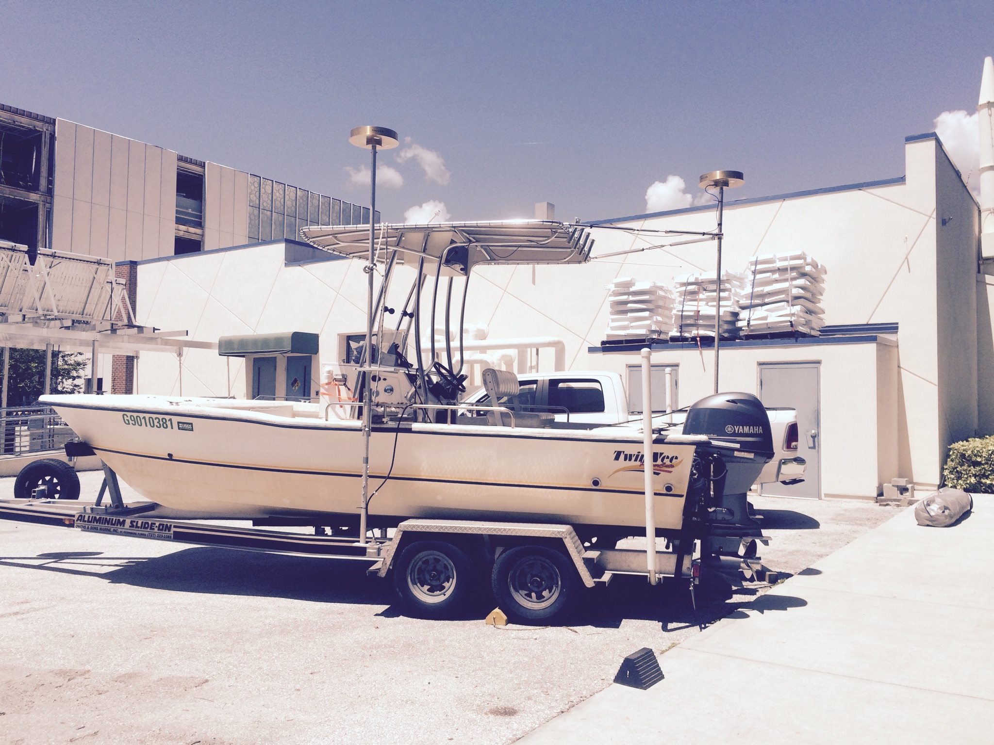
Scientific Purpose/Goals: We are testing SBB side mount on the R/V Jabba Jaw.
Vehicle(s):
Start Port/Location: USGS St. Pete / Deamons Landing Marina
End Port/Location: USGS St. Pete/ Deamons Landing Marina
Start Date: 2016-05-31
End Date: 2016-05-31
Equipment Used: TSS DMS-05 Motion Sensor, Single-beam Acoustic Sounder, ODOM-Echotrac CV-100, Ashtech ProFlex 800 GNSS Receiver, Choke Ring Antenna
Information to be Derived: The purpose of this testing is to understand the capabilities and limitations of single beam bathymetric acquisition.
Summary of Activity and Data Gathered: Single Beam data was collected using two different mounting locations on the R/V Jabba Jaw to determine which is best for quality data acquisition
Staff: Nancy DeWitt, Kyle Kelso
Affiliate Staff:
Notes: This is not an actual field activity but a test of field equipment prior to deployment and data collection; therefore, the Research Topic of TST (short for Test) was assigned.
Alternate names: 16TST01
Location:
Tampa Bay, FL and Vicinity
| Boundaries | |||
|---|---|---|---|
| North: 28.07918301 | South: 27.39142425 | West: -83.0772 | East: -82.26417861 |
Platform(s):
 Twin Vee (Jabba Jaw) |
| Survey Equipment | Survey Info | Data Type(s) | Data Collected |
|---|---|---|---|
| TSS DMS-05 Motion Sensor | This instrument did not collet individual files; rather it was streaming boat motion (heave, roll, and pitch) via the TSS320.dll driver into the HYPACK acquisition software. The strings of data are time stamped and located in the RAW HYPACK files. Example of data string: HCP 0 40073.584 -0.020 1.680 3.110. | Interferometric Single Beam | |
| Single-beam Acoustic Sounder | Please refer to OCOM-Echotrac CV-100 | Single Beam | |
| ODOM-Echotrac CV-100 | This instrument did not collect individual files; rather it was streaming depth below transducer via the OdomCV_3.dlldriver into the HYPACK acquisition software. | Single Beam | |
| Ashtech ProFlex 800 GNSS Receiver | Raw GPS files collected using the Ashtech ProFlex 800 GNSS receivers. Satellite signals were received via the Choke ring antennas for the base stations and the boat. A NMEA GGA data string was streaming from the GPS receiver into HYAPCK acquisition software via the GPS.dll driver providing navigation data. | Benchmarks Navigation | |
| Choke Ring Antenna | The satellite L1/L2 signals were received via the Ashtech choke-ring antennas for the base station and the boat. The Ashtech ProFlex 800 GNSS receivers interpret the signals and record the information as binary files. 317 MB | Benchmarks Navigation |