AKA: DL616
Other ID: none
Status: Completed
Organization(s): USGS, Pacific Coastal and Marine Science Center
Funding Program(s): Sediment Transport in Coastal Environments (ZP00FDB)
Principal Investigator(s): Jessica Lacy
Affiliate Investigator(s): Jon Burau USGS Tara Morgan USGS
Information Specialist(s): Emily Carlson
Data Type(s): Environmental Data: CTD, Environmental Data: Turbidity, Environmental Data: Wave, Location-Elevation: Navigation, Sampling: Geology, Time Series: Mooring (physical oceanography)
Scientific Purpose/Goals: To improve the scientific basis for shallow water habitat restoration to support fisheries in the San Francisco Bay Delta, in collaboration with scientists from the CA Water Science Center.
Vehicle(s): MarFac; Chevy Suburban - gray; 7 pass; G62-2874L
Start Port/Location: Rio Vista, CA
End Port/Location: Rio Vista, CA
Start Date: 2016-06-07
End Date: 2016-08-19
Equipment Used: CTD, Other, turbiditymeter, Other, pushcore, Moorings - Tripods
Information to be Derived: mooring data and mooring logs added to FAD 1/30/2017 Time series of suspended sediment concentration, tidal stage, and wave attributes.
Summary of Activity and Data Gathered: mooring data and mooring logs added to FAD 1/30/2017 sample analysis submitted to FAD 10/12/2016
Staff: Emily Carlson, Peter Dal Ferro, Cordell Johnson, Daniel Powers
Affiliate Staff:
Notes: Three days for deployment, two for recovery.
Information specialist is Emily Carlson.
Entries for this field activity are based on entries from Field Activity 2014-655-FA.
Entries for this field activity are based on entries from Field Activity 2015-659-FA
Entries for this field activity are based on entries from Field Activity 2015-663-FA
Entries for this field activity are based on entries from Field Activity 2015-678-FA
Entries for this field activity are based on entries from Field Activity 2016-607-FA
Entries for this field activity are based on entries from Field Activity 2016-623-FA
Location:
San Francisco Bay Delta, Little Holland Tract, California
| Boundaries | |||
|---|---|---|---|
| North: 38.34440275 | South: 38.22842333 | West: -121.729 | East: -121.63231728 |
Platform(s):
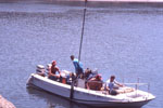
 Fast Eddy (SC) |
Lacy, J.R., Carlson, E.M., and Ferreira, J.C.T., 2019, Wind-wave and sediment-transport time-series data from Liberty Island and Little Holland Tract, Sacramento-San Joaquin Delta, California, 2015-2017 (ver. 2.0, September 2019): U.S. Geological Survey data release, https://doi.org/10.5066/F73R0R07.
Lacy, J.R., Dailey, E.T., and Carlson, E.M., 2018, Bed sediment properties in Little Holland Tract and Liberty Island, Sacramento-San Joaquin Delta, California, 2014 to 2017: U.S. Geological Survey data release.
| Survey Equipment | Survey Info | Data Type(s) | Data Collected |
|---|---|---|---|
| CTD | --- | Surveys (geochemical) Experiments (geochemical) CTD | |
| Other | --- | --- | --- |
| turbiditymeter | --- | Turbidity | |
| Other | --- | --- | --- |
| pushcore | --- | Geology | Grain size and bulk density of sediment cores from Little Holland Tract and Liberty Island, Sacramento-San Joaquin Delta, California, 2016 (Grain size distribution and bulk density are reported for sediment push cores from two flooded agricultural tracts, Little Holland Tract and Liberty Island, in the Sacramento-San Joaquin Delta, California. Push core samples were collected from 17 sites by the U.S. Geological Survey in June 2016. Each core was analyzed at multiple depths to investigate variations in particle sizes with depth below the sediment surface. The same sites were sampled previously in 2014 (https://www.sciencebase.gov/catalog/item/5a73a58fe4b0a9a2e9e172cf). These data provide insight into the variation of particle size distributions in space, bed depth, and time.) |
| Moorings - Tripods | --- | Mooring (physical oceanography) |