AKA: none
Other ID: none
Status: Completed
Organization(s): USGS, Pacific Coastal and Marine Science Center
Funding Program(s): Other (Other)
Principal Investigator(s): Daniel Brothers
Affiliate Investigator(s): Amy East, USGS PCMSC Nathan Miller, USGS WHSC Dan Ebuna, UC Santa Cruz
Information Specialist(s): Alicia Balster-gee
Data Type(s): Location-Elevation: Navigation, Seismics: Multichannel, Seismics: Sparker
Scientific Purpose/Goals: Mapping Queen Charlotte/Fairweather Fault zone to constrain earthquake hazards.
Vehicle(s): None
Start Port/Location: Seward, AK
End Port/Location: Seward, AK
Start Date: 2016-08-07
End Date: 2016-08-26
Equipment Used: Yonav, Other, Multichannel, Sparker
Information to be Derived: high-resolution multichannel seismic reflection profiles
Summary of Activity and Data Gathered: MCS data submitted to FAD 2/6/2017 by Alicia Balster-gee
Staff: Alicia Balster-gee, Daniel Brothers, Jackson Currie, Amy East
Affiliate Staff:
Notes: 16 days at sea. The rest of the dates are for mob and demob. Platform is the R/V Norseman.
Location:
Gulf of Alaska
| Boundaries | |||
|---|---|---|---|
| North: 60.73911751 | South: 54.63955538 | West: -147.794 | East: -133.78027201 |
Platform(s):
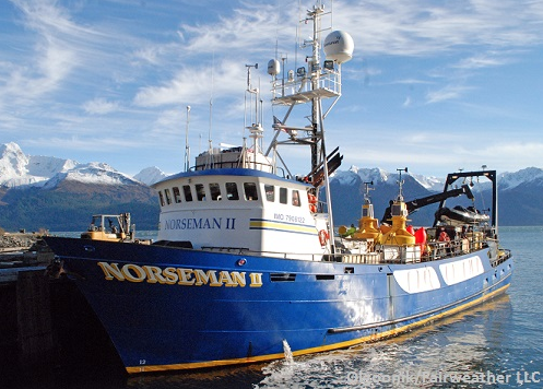 Norseman_II |
Balster-Gee, A.F., Brothers, D.S., Miller, N.C., Kluesner, J.W., Ebuna, D.R., and East, A.E., 2017, Multichannel sparker seismic-reflection data of field activity 2016-656-FA; between Icy Point and Dixon Entrance, Gulf of Alaska from 2016-08-07 to 2016-08-26: U.S. Geological Survey data release.
| Survey Equipment | Survey Info | Data Type(s) | Data Collected |
|---|---|---|---|
| Yonav | --- | Navigation | |
| Other | --- | --- | --- |
| Multichannel | --- | Multichannel | Multichannel sparker seismic-reflection data between Icy Point and Dixon Entrance, Gulf of Alaska from 2016-08-07 to 2016-08-26 (This data release contains high-resolution multichannel seismic (MCS) reflection data collected in August of 2016 along the southeast Alaska continental margin. Structure perpendicular MCS profiles were collected along the Queen Charlotte-Fairweather fault. The data were collected aboard the R/V Norseman using a Delta sparker sound source and recorded on a 64-channel digital streamer. Subbottom acoustic penetration spans up to several hundreds of meters, and is variable by location.) |
| Sparker | --- | Sparker |
