Other ID: none
Status: Pending
Organization(s): USGS, Woods Hole Coastal and Marine Science Center
Funding Program(s): USGS GAS HYDRATES (LQ000FP)
Principal Investigator(s): Carolyn Ruppel
Affiliate Investigator(s): Amanda Demopoulos, USGS; Nancy Prouty, USGS; Dan Condon, BGS; Diana Sahy, BGS
Information Specialist(s): Carolyn Ruppel
Data Type(s): Seismics: Sub Bottom Profiler, Biological Field Study: Surveys (biological), Environmental Data: CTD, Imagery: Photo, Imagery: Video, Location-Elevation: Navigation, Location-Elevation: Transects, Sampling: Biology, Sampling: Chemistry, Sampling: Geology, Sonar: Multibeam, Sonar: Sound Velocity
Scientific Purpose/Goals: Collect geologic and biological samples from Atlantic methane seeps; survey for methane plumes and acquire seafloor backscatter data
Vehicle(s):
Start Port/Location: Lewes, DE
End Port/Location: Lewes, DE
Start Date: 2017-05-01
End Date: 2017-05-12
Equipment Used: Edgetech chirp subbottom profiler 512i, POS-MV, GPS (wh), SBE 911plus CTD, SIMRAD EK60, Sample containers, Other, Other, Reson 7160 (used in WH)
Information to be Derived: water column imagery, seafloor backscatter, seawater parameters, ecology, authigenic carbonate dates
Summary of Activity and Data Gathered: Conducted several ROV dives on seeps between just south of Norfolk Canyon northward to Baltimore Canyon. Benthic ecologists collected samples, and extensive geophysical surveys completed. Additional supporting geophysical data acquired for analysis at WHCMSC
Staff: Eric Moore, Charles Worley
Affiliate Staff:
Notes: Project funded by NOAA OER on R/V SHarp with Global Explorer ROV; anticipate 2-3 USGS operational personnel needed for activity, which will include EK80, USGS-run USBL (rental), and possibly a pole-mounted leased MBES
Location:
Atlantic margin, Hatteras to Baltimore Canyon, shelf-break to 1500 m water depth
| Boundaries | |||
|---|---|---|---|
| North: 38.908133 | South: 35.13787912 | West: -76.2890625 | East: -73.58642578 |
Platform(s):
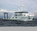 Hugh R. Sharp |  Global Explorer ROV |
Baldwin, W.E., Moore, E.M., Worley, C.R., Nichols, A.R., and Ruppel, C.D., 2020, Marine geophysical data collected to support methane seep research along the U.S. Atlantic continental shelf break and upper continental slope between the Baltimore and Keller Canyons during U.S. Geological Survey Field Activities 2017-001-FA and 2017-002-FA: U.S. Geological Survey data release, https://doi.org/10.5066/P9Y1MSTN.
Leonte, M., Ruppel, C.D., Ruiz-Angelo, A., and Kessler, J.D., 2020, Surface methane concentrations along the Mid‐Atlantic Bight driven by aerobic subsurface production rather than seafloor gas seeps: Journal of Geophysical Research Oceans, v. 125, issue 5, https://doi.org/10.1029/2019JC015989.
Ruppel, C., Demopoulos, A., and Prouty, N., 2017, Exploring U.S. Mid-Atlantic Margin Methane Seeps: IMMeRSS, May 2017: NOAA Ocean Exploration.
Ruppel, C., Demopoulos, A.,, P., N., Sahy, D., Condon, D., 2017, Exploring U.S. Atlantic Margin Methane Seeps with a Remotely-Operated Vehicle: Fire in the Ice, DOE Newsletter, v. 17 no. 2, URL: https://www.netl.doe.gov/File%20Library/Research/Oil-Gas/methane%20hydrates/MHNews_2017_Summer.pdf#page=12.
Ruppel, C., Skarke, A., Miller, N., Kidiwela, M., Kluesner, J., Baldwin, W., 2024, Methane seeps on the U.S. Atlantic margin: An updated inventory and interpretative framework, Marine Geology, Volume 471, 107287, ISSN 0025-3227, https://doi.org/10.1016/j.margeo.2024.107287.
| Survey Equipment | Survey Info | Data Type(s) | Data Collected |
|---|---|---|---|
| Edgetech chirp subbottom profiler 512i | ?not used on this cruise? | Sub Bottom Profiler | |
| POS-MV | Supplied navigation to the USBL system intermittently until May 4. Primarily used for the multibeam systems (SIMRAD EK60 and Reson 7160). | Navigation | |
| GPS (wh) | Hemisphere GPS. Ship navigation system supplied to the Applied Acoustics EasyTrack Nexus 2 USBL system after May 4. | Navigation | 2017-001-FA_ROVUSBLNav (Ultra-short baseline - navigation points and tracklines for Applied Acoustics EasyTrack Nexus 2 USBL data collected for ROV Global Explorer during USGS field activity 2017-001-FA along the U.S. Atlantic continental shelf break and upper continental slope between the Baltimore and Keller Canyons) |
| SBE 911plus CTD | --- | CTD | |
| SIMRAD EK60 | --- | Surveys (biological) Surveys (geochemical) Multibeam Water column reflectivity | |
| Sample containers | --- | Biology Geology | |
| Other | --- | --- | --- |
| Other | --- | --- | --- |
| Reson 7160 (used in WH) | --- | Multibeam |
