Other ID: none
Status: Pending
Organization(s): USGS, Woods Hole Coastal and Marine Science Center
Funding Program(s): USGS GAS HYDRATES (LQ000FP)
Principal Investigator(s): Carolyn Ruppel
Affiliate Investigator(s): John Kessler, University of Rochester
Information Specialist(s): Carolyn Ruppel
Data Type(s): Location-Elevation: Navigation, Seismics: Sub Bottom Profiler, Sonar: Water column reflectivity, Environmental Data: CTD, Sonar: Multibeam
Scientific Purpose/Goals: Water column/seafloor imaging and CTDs to constrain impact of methane seepage on seafloor-water column-atmosphere system
Vehicle(s):
Start Port/Location: Lewes, DE
End Port/Location: Lewes, DE
Start Date: 2017-08-25
End Date: 2017-09-06
Equipment Used: POS-MV, SBE 911plus CTD, Edgetech chirp subbottom profiler 512i, SIMRAD EK60, Reson 7160 (used in WH)
Information to be Derived: bathymetry, seafloor backscatter, water column backscatter
Summary of Activity and Data Gathered: Collected geophysical data, CTDs, and water column methane carbon from roughly Baltimore Canyon south to Cape Hatteras. Data will be used to determine source of methane in water column, to identify new methane seeps, and to study deep-seated ocean acidification related to aerobic oxidation of methane in the water column. Geophysical data include some focused multibeam grids in places south to Cape Hatteras where we have not previously been able to acquire data.
Staff: Other
Affiliate Staff:
Notes:
Location:
Mid-Atlantic outer shelf and upper continental slope, Hatteras to Wilmington Canyons
| Boundaries | |||
|---|---|---|---|
| North: 38.89103283 | South: 34.95799531 | West: -76.26708984 | East: -73.56445313 |
Platform(s):
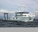 Hugh R. Sharp |
Baldwin, W.E., Moore, E.M., Worley, C.R., Nichols, A.R., and Ruppel, C.D., 2020, Marine geophysical data collected to support methane seep research along the U.S. Atlantic continental shelf break and upper continental slope between the Baltimore and Keller Canyons during U.S. Geological Survey Field Activities 2017-001-FA and 2017-002-FA: U.S. Geological Survey data release, https://doi.org/10.5066/P9Y1MSTN.
Joung, D., Ruppel, C.D., Southon, J., Weber, T.S., and Kessler, J.D., 2022, Negligible atmospheric release of methane from decomposing hydrates in mid-latitude oceans: Nature Geoscience https://doi.org/10.1038/s41561-022-01044-8.
Kessler, J.D., Ruppel, C.D., Joung, D., Garcia-Tigreros, F., and Leonte, M., 2018, Exploring the Impact of Widespread Seafloor Methane Seepage on Atmospheric Methane Emissions and Ocean Chemistry: Methane Hydrate News, Fire in the Ice, vol. 18, Issue 1, https://www.netl.doe.gov/sites/default/files/publication/MHNews_2018_Summer.pdf.
Leonte, M., Ruppel, C.D., Ruiz-Angelo, A., and Kessler, J.D., 2020, Surface methane concentrations along the Mid‐Atlantic Bight driven by aerobic subsurface production rather than seafloor gas seeps: Journal of Geophysical Research Oceans, v. 125, issue 5, https://doi.org/10.1029/2019JC015989.
Ruppel, C., Skarke, A., Miller, N., Kidiwela, M., Kluesner, J., Baldwin, W., 2024, Methane seeps on the U.S. Atlantic margin: An updated inventory and interpretative framework, Marine Geology, Volume 471, 107287, ISSN 0025-3227, https://doi.org/10.1016/j.margeo.2024.107287.
| Survey Equipment | Survey Info | Data Type(s) | Data Collected |
|---|---|---|---|
| POS-MV | Navigation data were acquired using the WGS 84 coordinate system with an Applanix POS MV Wavemaster (model 220, v5), which blends Global Navigation Satellite System (GNSS) and acceleration data from an Inertial Motion Unit (IMU) and GPS azimuthal heading. | Navigation | |
| SBE 911plus CTD | --- | CTD | |
| Edgetech chirp subbottom profiler 512i | --- | Sub Bottom Profiler | 2017-002-FA_SB512i (Chirp seismic reflection - shotpoints, tracklines, profile images, and SEG-Y traces for EdgeTech SB-512i chirp data collected during USGS field activity 2017-002-FA along the U.S. Atlantic continental shelf break and upper continental slope between the Baltimore and Keller Canyons) |
| SIMRAD EK60 | --- | Surveys (biological) Surveys (geochemical) Multibeam Water column reflectivity | |
| Reson 7160 (used in WH) | --- | Multibeam |
