Other ID: none
Status: Cancelled
Organization(s): USGS, Woods Hole Coastal and Marine Science Center
Funding Program(s): High-resolution geologic mapping offshore of Massachusetts (LQ00AWW)
Principal Investigator(s): Laura Brothers, William Schwab
Affiliate Investigator(s):
Information Specialist(s): Seth Ackerman
Data Type(s): Imagery: Photo, Imagery: Video, Sampling: Geology
Scientific Purpose/Goals: To collect ground truth samples to help characterize the seafloor
Vehicle(s):
Start Port/Location: Falmouth, MA
End Port/Location: Falmouth, MA
Start Date: 2017-05-02
End Date: 2017-05-04
Equipment Used: Digital video camera, GoPro camera, SeaBOSS, Digital camera
Information to be Derived: grain size, seafloor character
Summary of Activity and Data Gathered:
Staff: Seth Ackerman, Dann Blackwood, Laura Brothers
Affiliate Staff:
Notes: Mini Sea Boss operations will be conducted North of Nantucket as part of an agreement with MA CZM to map the geology of MA waters.
Entries for this field activity are based on entries from Field Activity 2016-005-FA
Location:
North of Nantucket, Massachusetts, United States, Atlantic Ocean
| Boundaries | |||
|---|---|---|---|
| North: 41.47070833 | South: 41.3427489 | West: -70.11335977 | East: -69.97301636 |
Platform(s):
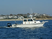
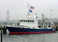
 Rafael |  Tioga |
| Survey Equipment | Survey Info | Data Type(s) | Data Collected |
|---|---|---|---|
| Digital video camera | --- | Video | |
| GoPro camera | --- | Photo Video | |
| SeaBOSS | --- | Surveys (biological) Experiments (biological) Species ID Photo Video Geology Biology | |
| Digital camera | --- | Photo |