AKA: none
Other ID: none
Status: Completed
Organization(s): USGS, Pacific Coastal and Marine Science Center
Funding Program(s): Sediment Transport in Coastal Environments (ZP00FDB)
Principal Investigator(s): Jessica Lacy
Affiliate Investigator(s):
Information Specialist(s): Andrew Stevens
Data Type(s): Imagery: Photo, Location-Elevation: Navigation, Location-Elevation: Transects, Sonar: Single Beam
Scientific Purpose/Goals: Topographic and Bathymetric survey of Little Holland Tract and Wildlands restoration site
Vehicle(s): MarFac; Chevy Suburban - gray; 7 pass; G62-2874L
Start Port/Location: Rio Vista, CA
End Port/Location: Rio Vista, CA
Start Date: 2017-06-26
End Date: 2017-06-30
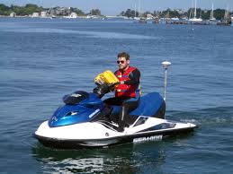
Equipment Used: Waverunners, camera, Trimble R7 GPS (AS)
Information to be Derived: Combined topographic/bathymetric map of Little Holland Tract and Wildlands restoration site.
Summary of Activity and Data Gathered: base, bathy, field_notes, matlab, photos, planning.svp, and topo data submitted to FAD 6/29/2017; Andrew Stevens
Staff: Timothy Elfers, Cordell Johnson, Alexander Snyder, Andrew Stevens
Affiliate Staff:
Notes: Entries for this field activity are based on entries from Field Activity 2015-642-FA
Location:
Rio Vista, CA Little Holland Tract, Sacramento River Delta
| Boundaries | |||
|---|---|---|---|
| North: 38.39226254 | South: 38.26247087 | West: -121.708 | East: -121.63314819 |
Platform(s):
 Fast Eddy (SC) | Unknown |  Waverunner 1 (SC) |  Waverunner 2 (SC) |
Fregoso, T.A., Stevens, A.W., Wang, R.-F., Handley, T., Dartnell, P., Lacy, J.R., Ateljevich, E., and Dailey, E.T., 2020, Bathymetry, topography, and acoustic backscatter data, and a digital elevation model (DEM) of the Cache Slough Complex and Sacramento River Deep Water Ship Channel, Sacramento-San Joaquin Delta, California: U.S. Geological Survey data release, https://doi.org/10.5066/P9AQSRVH.
| Survey Equipment | Survey Info | Data Type(s) | Data Collected |
|---|---|---|---|
| Waverunners | --- | Navigation Single Beam | |
| camera | --- | Photo | |
| Trimble R7 GPS (AS) | --- | Benchmarks Navigation Profiles Transects | Topography data collected in the Liberty Island Conservation Bank portion of the Cache Slough Complex (This portion of the USGS data release presents topography data acquired in the Liberty Island Conservation Wildlands restoration site in 2017 (USGS Field Activity Number 2017-649-FA). Topographic data were collected on June 26 and 27, 2017 by walking with global navigation satellite system (GNSS) receivers mounted on backpacks. Hand-held data collectors were used to log raw data and display navigational information as the surveyors traversed the landscape. The final point data are provided in a comma-separated text file and are projected in cartesian coordinates using the Universal Transverse Mercator (UTM) Zone 10 North, meters coordinate system.) |