AKA: none
Other ID: none
Status: Completed
Organization(s): USGS, Pacific Coastal and Marine Science Center
Funding Program(s): Past, Present and Future Coral Reefs (ZP00FRV)
Principal Investigator(s): Nancy Prouty
Affiliate Investigator(s): Ku'ulei Rodgers -UH
Information Specialist(s): Joshua Logan
Data Type(s): Location-Elevation: Navigation, Sampling: Biology
Scientific Purpose/Goals: collect coral cores for evaluating coral reef health and land use change
Vehicle(s): None
Start Port/Location: Pila'a Beach, Kauai, Hawii
End Port/Location: Pila'a Beach, Kauai, Hawii
Start Date: 2017-06-19
End Date: 2017-06-23
Equipment Used: coral_core, Handheld GPS
Information to be Derived: coral health and history of sediment loading
Summary of Activity and Data Gathered: 7 coral cores were collected as follows: Latitude Longitude Site ID DOC 22.2119645 -159.3579703 Usgs01 6/20/17 10:26 22.2120051 -159.357987 Usgs02 6/20/17 13:17 22.2121678 -159.3573341 Usgs03 6/20/17 13:47 22.2138491 -159.3654837 Usgs04 6/21/17 10:12 22.2144778 -159.3656179 Usgs05 6/21/17 10:15 22.212264 -159.3577653 Usgs06 6/22/17 9:57 22.2123844 -159.3578545 Usgs07 6/22/17 10:35
Staff: Peter Dal Ferro
Affiliate Staff:
Notes:
Location:
Pila'a beach, Kauai
| Boundaries | |||
|---|---|---|---|
| North: 22.21291919 | South: 22.2101389 | West: -159.36710581 | East: -159.3629583 |
Platform(s):
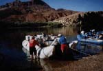
 Raft |
| Survey Equipment | Survey Info | Data Type(s) | Data Collected |
|---|---|---|---|
| coral_core | --- | Biology | |
| Handheld GPS | --- | Navigation |