AKA: none
Other ID: none
Status: Completed
Organization(s): USGS, Pacific Coastal and Marine Science Center
Funding Program(s): Coastal and marine earthquake, tsunami, and landslide active margin field studies (ZP00EQV)
Principal Investigator(s): Daniel Brothers, James Conrad
Affiliate Investigator(s): H. Gary Greene (Sitka Sound Science Center), J. Vaughn Barrie (Geological Survey of Canada)
Information Specialist(s): James Conrad
Data Type(s): Location-Elevation: Navigation, Sampling: Geology, Seismics: Multichannel, Seismics: Sparker, Seismics: Sub Bottom Profiler
Scientific Purpose/Goals: Neotectonics investigation of the Queen Charlotte-Fairweather Fault System
Vehicle(s): MarFac; Ford 650 Box truck - White G71-03559
Start Port/Location: Sidney, British Columbia, Canada
End Port/Location: Sidney, British Columbia, Canada
Start Date: 2017-09-09
End Date: 2017-10-03
Equipment Used: grab sampler, navigation, Multichannel, chaindredge, Other, Knudsen Chirp 3200, Mini sparker, minisparker
Information to be Derived: To image fault offsets and collect samples to determine reflection ages.
Summary of Activity and Data Gathered: Data and samples will be archived at the Geological Survey of Canada.
Staff: Daniel Brothers, James Conrad, Amy East, Rachel Marcuson, Mary McGann
Affiliate Staff:
Notes: Data and samples will be archived at the Geological Survey of Canada.
IKU grab sampler
Location:
Puget Sound, WA, SE Alaska, and NW Canada, Pacific Ocean
| Boundaries | |||
|---|---|---|---|
| North: 58.82208 | South: 47.89893 | West: -137.681 | East: -122.17122 |
Platform(s):
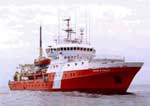 John P Tully |
McGann, M., Enkin, R.J., Hamilton, T.S., Barrie, J.V., Brothers, D.S., Greene, H.G., Maier, K.L., Conrad, J.E., Lauer, R.M., East, A.E., Conway, K.W., Neelands, P.J., and Marcuson, R.K., 2024, Radiocarbon age dating of biological material from cores collected off British Columbia, Canada and southeastern Alaska, U.S. along the Queen Charlotte-Fairweather fault zone: U.S. Geological Survey data release, https://doi.org/10.5066/P96QMQJT.
Prouty, N.G., Lorenson, T.D., and Law, M.D., 2019, Geochemical analysis of seeps along the Queen Charlotte Fault: U.S. Geological Survey data release, https://doi.org/10.5066/P9RK94EE.
| Survey Equipment | Survey Info | Data Type(s) | Data Collected |
|---|---|---|---|
| grab sampler | --- | Surveys (geochemical) Geology | Geochemical analysis of seeps along the Queen Charlotte Fault (Geochemical analyses of authigenic carbonates, bivalves, and pore fluids were performed on samples collected from seep fields along the Queen Charlotte Fault, a right lateral transform boundary that separates the Pacific and North American tectonic plates. Samples were collected using grab samplers and piston cores, and were collected during three different research cruises in 2011, 2015, and 2017.) |
| navigation | --- | Navigation | |
| Multichannel | --- | Multichannel | |
| chaindredge | --- | Geology | |
| Other | --- | --- | --- |
| Knudsen Chirp 3200 | --- | Sub Bottom Profiler | |
| Mini sparker | --- | Sparker | |
| minisparker | --- | Sparker |
