AKA: none
Other ID: none
Status: Completed
Organization(s): USGS, Pacific Coastal and Marine Science Center
Funding Program(s): Other (Other)
Principal Investigator(s): Jenna Hill
Affiliate Investigator(s):
Information Specialist(s): Jenna Hill
Data Type(s): Location-Elevation: Navigation, Sampling: Geology, Seismics: Sub Bottom Profiler
Scientific Purpose/Goals: To provide age constraints on iceberg scour events.
Vehicle(s): None
Start Port/Location: Lewes, DE
End Port/Location: Lewes, DE
Start Date: 2017-08-15
End Date: 2017-08-22
Equipment Used: navigation, gravitycore, 512 chirp-source, 512 chirp
Information to be Derived: Grain Size, 14C ages, 18O stratigraphy
Summary of Activity and Data Gathered: NSF funded; cores will have to be archived at an NSF-funded repository -- likely Oregon State or WHOI.
Staff: Jenna Hill
Affiliate Staff:
Notes: We will be using the Oregon State Univ. coring equipment with their "Big Bertha" rig -- it is essentially a piston core system rigged as a gravity core system.
Collaborative NSF-funded project with Coastal Carolina University, Conway, SC.
Location:
South Carolina, United States, Atlantic Ocean
| Boundaries | |||
|---|---|---|---|
| North: 33.01960326 | South: 32.34954875 | West: -78.77197266 | East: -77.7447161 |
Platform(s):
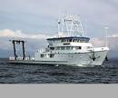
 Hugh R. Sharp |
| Survey Equipment | Survey Info | Data Type(s) | Data Collected |
|---|---|---|---|
| navigation | --- | Navigation | |
| gravitycore | --- | Geology | |
| 512 chirp-source | --- | Sub Bottom Profiler | |
| 512 chirp | --- | Sub Bottom Profiler |