AKA: none
Other ID: none
Status: Completed
Organization(s): USGS, Pacific Coastal and Marine Science Center
Funding Program(s): High Energy Active Margins (ZP00F00)
Principal Investigator(s): Li Erikson
Affiliate Investigator(s):
Information Specialist(s): Shawn Harrison, Joshua Logan, Andrew Stevens
Data Type(s): Imagery: Photo, Imagery: Video, Location-Elevation: Navigation, Location-Elevation: Profiles, Sampling: Geology, Sonar: Single Beam, Sonar: Sound Velocity
Scientific Purpose/Goals: Collect nearshore bathymetry and beach topography in Monterey Bay
Vehicle(s): MarFac; Chevy Suburban - gray; 7 pass; G62-2874L, MarFac; Expedition G62-3094P
Start Port/Location: Santa Cruz, CA
End Port/Location: Moss Landing, CA
Start Date: 2017-11-30
End Date: 2017-12-08
Equipment Used: Solo PCMSC01, Trimble R10 GPS (AS), Trimble R7 GPS (AS), Trimble R7 GPS receiver, grab sampler, Solo PCMSC02, Trimble R7 GPS receiver 9, Waverunners, YSI Sound velocity CTD
Information to be Derived: Nearshore bathymetry, beach topography using jetskis, GPS backpacks, UAS-derived photography for SfM and Argus products
Summary of Activity and Data Gathered: Base, bathy, field_notes, linefile, matlab, sediment_sampling, svp and topo submitted to FAD by Andrew Stevens 12/6/2017
Staff: Timothy Elfers, Shawn Harrison, Daniel Hoover, Cordell Johnson, SeanPaul La Selle, Joshua Logan, Thomas Reiss, Schuyler (Contractor) Smith, Alexander Snyder, Andrew Stevens
Affiliate Staff:
Notes: GGONR project
Local Fieldwork, NO OT
Entries for this field activity are based on entries from Field Activity 2016-627-FA
Entries for this field activity are based on entries from Field Activity 2016-674-FA
Entries for this field activity are based on entries from Field Activity 2017-620-FA
Entries for this field activity are based on entries from Field Activity 2017-678-FA
Location:
Monterey Bay, beaches and nearshore at Seascape and Sunset State Beach
| Boundaries | |||
|---|---|---|---|
| North: 36.95976848 | South: 36.86358951 | West: -121.88894641 | East: -121.81381225 |
Platform(s):
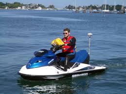
 Waverunner 1 (SC) |  Waverunner 2 (SC) |
| Survey Equipment | Survey Info | Data Type(s) | Data Collected |
|---|---|---|---|
| Solo PCMSC01 | --- | Photo Video | |
| Trimble R10 GPS (AS) | --- | Navigation Profiles | |
| Trimble R7 GPS (AS) | --- | Benchmarks Navigation Profiles Transects | |
| Trimble R7 GPS receiver | --- | Benchmarks LIDAR Navigation Profiles Transects | |
| grab sampler | --- | Surveys (geochemical) Geology | |
| Solo PCMSC02 | --- | Photo Video | |
| Trimble R7 GPS receiver 9 | --- | Benchmarks LIDAR Navigation Profiles Transects | |
| Waverunners | --- | Navigation Single Beam | |
| YSI Sound velocity CTD | --- | Sound Velocity |