Other ID: none
Status: Completed
Organization(s): USGS, Woods Hole Coastal and Marine Science Center
Funding Program(s): Marine Geohazards Sources and Probability (LQ00ENR)
Principal Investigator(s): Uri Ten Brink
Affiliate Investigator(s): Zvi Ben-Avraham (U. of Haifa); Eldad Levy (Geophysical Institute of Israel). Gideon Tibor (Israel Oceanographic and Limnological Institute); Steven Harder (U. Texas, El Paso). Organizations involved The Dr. Moses Strauss Department of Marine Geosciences, University of Haifa; Geophysical Institute of Israel; USGS
Information Specialist(s): Claudia Flores
Data Type(s): Seismics: Sonobuoy
Scientific Purpose/Goals: The main objective of the research was to obtain an image of the Dead Sea fault sub-surface geometry and a map of the sub-surface seismic velocities along the axis of the basin to a depth of 15-20 km at a resolution of ≥1 km.
Vehicle(s):
Start Port/Location: Tel Aviv, Israel
End Port/Location: Tel Aviv, Israel
Start Date: 2018-03-20
End Date: 2018-04-11
Equipment Used: Seismic refraction
Information to be Derived: Velocity-depth model of the Dead Sea Fault and Galilee, northern Israel
Summary of Activity and Data Gathered: Two perpendicular wide angle seismic refraction / reflection cross-sections were acquired in order to image the Dead Sea fault structure in the northern part of Israel; A west-east line, from the Mediterranean coast line near Acre in the west to the Syrian border in the Golan Heights in the East with total length of 72 km; A south-north line, from Kibbutz Kfar Rupin in the south to Almagor settlement in the north crossing the Sea of Galilee with total length of 50 km. The seismic energy sources were 12 underground explosive shots, 300–400 kilograms each located every ~10 km, while the 550 seismic receivers were located every ~200m along the lines. Local earthquakes and mining explosions were also recorded.
Staff: Nathaniel Miller, Uri Ten Brink
Affiliate Staff:
Notes: Funding: The Richard Lounsbery Foundation and the Israel Ministry of Energy
Data will be archived at the IRIS-DMC.
Additional information from Uri: Experiment in IRIS DMC: http://ds.iris.edu/mda/1C/?timewindow=2018-2018. Station location map: http://ds.iris.edu/gmap/#network=1C&starttime=2018-04-08T06:50:00&endtime=2018-04-11T16:00:00&datacenter=IRISPH5&planet=earth;
Equipment used: IRIS-PASSCAL Texan data loggers RT-125A with 4.5 Hz Geospace GS-11D vertical component geophones; Emulsion and Anfo explosives.
Land experiment; Minor deployment of modified marine seismometers using the Israel Oceanographic and Limnological Institute boats R/V Hermona and R/V Lillian.
Dat types: Seismic refraction and earthquake data.
Funding Projects: The Richard Lounsbery Foundation 601 Thirteenth Street, NW, Suite 1030N Washington, DC 20005; and Israel Ministry of National Infrastructures, Division of Research and Development, P.O.Box 36148, 9136002 Jerusalem, Israel
Location:
Galilee, Sea of Galilee, Israel, Middle East, Northern Israel, Jordan River Valley
| Boundaries | |||
|---|---|---|---|
| North: 32.7 | South: 32.45 | West: 35.07 | East: 35.86 |
Platform(s):
 on foot | Hermona | 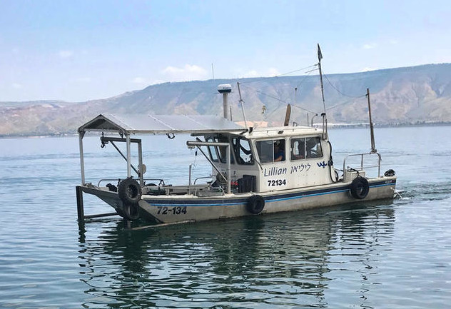 Lillian |
| Survey Equipment | Survey Info | Data Type(s) | Data Collected |
|---|---|---|---|
| Seismic refraction | --- | Sonobuoy |
