Other ID: none
Status: Completed
Organization(s): USGS, Woods Hole Coastal and Marine Science Center
Funding Program(s): Other (Other)
Principal Investigator(s): Walter Barnhardt
Affiliate Investigator(s):
Information Specialist(s): Brian Andrews
Data Type(s): Location-Elevation: Navigation, Sampling: Geology, Seismics: Boomer, Seismics: Sub Bottom Profiler, Sonar: Multibeam, Sonar: Sound Velocity
Scientific Purpose/Goals: To collect baseline geophysical data on the distribution and thickness of reworked mine tailings on the lake bottom near Buffalo Reef.
Vehicle(s):
Start Port/Location: Houghton, MI
End Port/Location: Houghton, MI
Start Date: 2018-09-13
End Date: 2018-09-27
Equipment Used: POS-MV, Van Veen grab sampler, EdgeTech 424 chirp sub-bottom profiler, Boomer, Benthos AQ-4 10-element hydrophone streamer, Reson T20-P, Sensor - SVP
Information to be Derived: bathymetry, backscatter, modern sediment thickness, depth to basement (i.e., top of Pleistocene)
Summary of Activity and Data Gathered: Covered approximately 309 square kilometers of Reson T20P (dual head) bathymetry and backscatter along 387 kilometers of survey lines. Collected (first) 3 days of Boomer data along 115 kms of tracklines. Collected 4 days of 424 Chirp data along 272 kms of tracklines. Collected 17 sediment samples on last day (Sept 26th)
Staff: Brian Andrews, Walter Barnhardt, David Foster, Barry Irwin, Alexander Nichols, Other
Affiliate Staff:
Notes:
Location:
Big Traverse Bay, Lake Superior, Michigan, United States
| Boundaries | |||
|---|---|---|---|
| North: 47.22502 | South: 47.147484 | West: -88.248604 | East: -88.120621 |
Platform(s):
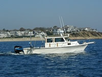
 Rafael |
Andrews, B.D., Barnhardt, W.A., Foster, D.S., Irwin, B.J., and Nichols, A.R., 2020, High-resolution geophysical data collected in the vicinity of Buffalo Reef, Michigan, within Lake Superior, U.S. Geological Survey Field Activity 2018-043-FA: U.S. Geological Survey data release, https://doi.org/10.5066/P9K4HX8V.
| Survey Equipment | Survey Info | Data Type(s) | Data Collected |
|---|---|---|---|
| POS-MV | --- | Navigation | 2018-043-FA_ResonT20P_Tracklines (Multibeam bathymetric trackline data collected in the vicinity of Buffalo Reef, Michigan, within Lake Superior during USGS Field Activity 2018-043-FA using a dual-head Reson T20-P multibeam echosounder (Esri polyline shapefile, Geographic, WGS 84)) |
| Van Veen grab sampler | --- | Geology | 2018-043-FA_SedimentSamples (Sediment sample locations and analysis collected in the vicinity of Buffalo Reef, Michigan, within Lake Superior during USGS Field Activity 2018-043-FA (Microsoft Excel file)) |
| EdgeTech 424 chirp sub-bottom profiler | --- | Sub Bottom Profiler | 2018-043-FA_Edgetech424_500sht (Seismic Reflection, EdgeTech SB-424 Chirp shot points collected in the vicinity of Buffalo Reef, Michigan, within Lake Superior during USGS field activity 2018-043-FA, (CSV text and Esri point shapefile, GCS WGS 84)) 2018-043-FA_Edgetech424_Tracklines (Seismic Reflection, EdgeTech SB-424 Chirp tracklines collected in the vicinity of Buffalo Reef, Michigan, within Lake Superior during USGS field activity 2018-043-FA, (Esri polyline shapefile, GCS WGS 84)) 2018-043-FA_Edgetech424_Images (Seismic Reflection, EdgeTech SB-424 Chirp profile images collected in the vicinity of Buffalo Reef, Michigan, within Lake Superior, during USGS field activity 2018-043-FA, (PNG Images)) |
| Boomer | --- | Boomer | |
| Benthos AQ-4 10-element hydrophone streamer | --- | Air Gun / Water Gun Boomer Sparker | 2018-043-FA_Boomer_Tracklines (Seismic Reflection, Boomer tracklines collected in the vicinity of Buffalo Reef, Michigan, within Lake Superior, during USGS field activity 2018-043-FA, (Esri polyline shapefile, GCS WGS 84)) 2018-043-FA_Boomer_500sht (Seismic Reflection, Boomer shot points collected in the vicinity of Buffalo Reef, Michigan, within Lake Superior, during USGS field activity 2018-043-FA, (CSV text and Esri point shapefile, GCS WGS 84)) 2018-043-FA_Boomer_Images (Seismic Reflection, Boomer profile images collected in the vicinity of Buffalo Reef, Michigan, within Lake Superior,during USGS field activity 2018-043-FA, (PNG Images)) |
| Reson T20-P | --- | Multibeam Water column reflectivity | 2018-043-FA_ResonT20P_Backscatter_2m (Multibeam backscatter data collected in the vicinity of Buffalo Reef, Michigan, within Lake Superior during USGS Field Activity 2018-043-FA using a dual-head Reson T20-P multibeam echosounder (8-bit GeoTIFF, UTM Zone 16N, NAD 83, 2-m resolution)) 2018-043-FA_ResonT20P_Bathymetry_2m (Multibeam bathymetric data collected in the vicinity of Buffalo Reef, Michigan, within Lake Superior during USGS Field Activity 2018-043-FA using a dual-head Reson T20-P multibeam echosounder (32-bit GeoTIFF, UTM Zone 16N, NAD 83, NAVD 88 Vertical Datum, 2-m resolution)) |
| Sensor - SVP | --- | Sound Velocity |