Other ID: none
Status: Completed
Organization(s): USGS, Woods Hole Coastal and Marine Science Center, USGS, Alaska Science Center, Woods Hole Oceanographic Institution
Funding Program(s): Other (Other)
Principal Investigator(s): Other
Affiliate Investigator(s):
Information Specialist(s): William Danforth, Charles Worley
Data Type(s): Seismics: Ocean Bottom Seismometer, Sonar: Multibeam
Scientific Purpose/Goals: Provide support (cruise participation only) for MBES collection and OBS deployment.
Vehicle(s):
Start Port/Location: Seward, Alaska
End Port/Location: Seward, Alaska
Start Date: 2018-07-06
End Date: 2018-07-27
Equipment Used: Other, Ocean Bottom Seismometer, EM 302
Information to be Derived: N/A
Summary of Activity and Data Gathered: Deployed 30 ocean bottom seismometers
Staff: William Danforth, Charles Worley
Affiliate Staff:
Notes: Platform: R/V Sikuliaq, operated by the University of Alaska
Location:
Aleutian Islands, Gulf of Alaska
| Boundaries | |||
|---|---|---|---|
| North: 62.79581584 | South: 53.13589354 | West: -167.265625 | East: -138.3984375 |
Platform(s):
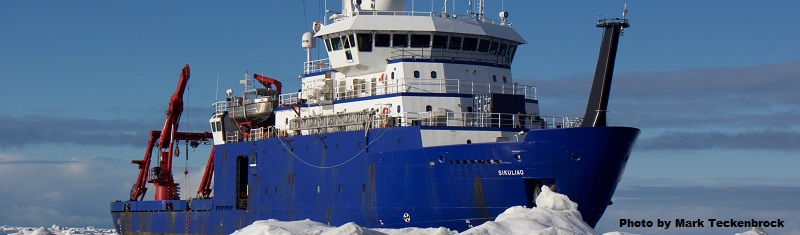 Sikuliaq |
| Survey Equipment | Survey Info | Data Type(s) | Data Collected |
|---|---|---|---|
| Other | --- | --- | --- |
| Ocean Bottom Seismometer | --- | Ocean Bottom Seismometer | |
| EM 302 | --- | Multibeam |
