AKA: IAV18
Other ID: none
Status: Completed
Organization(s): USGS, Pacific Coastal and Marine Science Center
Funding Program(s): Sediment Transport in Coastal Environments (ZP00FDB)
Principal Investigator(s): Jessica Lacy
Affiliate Investigator(s):
Information Specialist(s): Joanne Thede
Data Type(s): Location-Elevation: Navigation, Sampling: Biology, Sampling: Geology, Sonar: Interferometric, Sonar: Sound Velocity, Time Series: Mooring (physical oceanography)
Scientific Purpose/Goals: Determine the influence of aquatic vegetation on turbidity and sediment transport.
Vehicle(s): MarFac; Chevy Suburban - gray; 7 pass; G62-2874L, MarFac; Expedition G62-3094P
Start Port/Location: Isleton, CA
End Port/Location: Isleton, CA
Start Date: 2018-03-12
End Date: 2018-03-30
Equipment Used: sampling equipment, Hand-grab sample, Moorings - Tripods, GPS, SWATH plus-M , POS MV, soundvelocityprofiler, YoNav, OBS
Information to be Derived: Current speed and suspended sediment concentration.
Summary of Activity and Data Gathered: 2018-609-FA_Postprocessed data submitted to FAD 10/2/2018 GIS, POS-MV, SVP, SWATHPlus, Tides and YoNav folders submitted to FAD by Pete Dartnell 4/2/2018 2018-609-FA SSC data submitted from Mike Torresan to FAD
Staff: Joanne Thede, Cordell Johnson, Jessica Lacy, Daniel Powers
Affiliate Staff:
Notes:
Location:
Sacramento-San Joaquin Delta, California, United States
| Boundaries | |||
|---|---|---|---|
| North: 38.133 | South: 37.93 | West: -121.6 | East: -121.48 |
Platform(s):
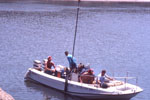
 Fast Eddy (SC) |  Parke Snavely |
Drexler, J.Z., Khanna, S., and Lacy, J.R., 2021, Carbon storage and sediment trapping by a globally invasive freshwater macrophyte: Science of the Total Environment, v. 755, doi: 10.1016/j.scitotenv.2020.142602.
Fregoso, T.A., and Jaffe, B.E., 2020, Pilot study on bathymetric change analyses in the Sacramento-San Joaquin Delta, California: U.S. Geological Survey data release, https://doi.org/10.5066/P976WNNN.
Lacy, J.R., Ferreira, J.C.T., Dailey, E.T., Dartnell, P., Drexler, J.Z., Allen, R.M., and Stevens, A., 2020, Sediment transport and aquatic vegetation data from three locations in the Sacramento-San Joaquin Delta, California, 2017 to 2018: U.S. Geological Survey data release, https://doi.org/10.5066/P9112AIP.
Lacy, J.R., Foster-Martinez, M., Allen, R.M., and Drexler, J.Z., 2021, Influence of invasive submerged aquatic vegetation (E. densa) on currents and sediment transport in a freshwater tidal system: Water Resources Research, v. 57, e2020WR028789 p., doi: 10.1029/2020WR028789.
| Survey Equipment | Survey Info | Data Type(s) | Data Collected |
|---|---|---|---|
| sampling equipment | --- | Biology Chemistry Geology Experiments (biological) Sediment Properties | |
| Hand-grab sample | --- | Biology Chemistry Geology | |
| Moorings - Tripods | --- | Mooring (physical oceanography) | |
| GPS | --- | Navigation | |
| SWATH plus-M | --- | Interferometric | Bathymetric change analyses of the southernmost portion of the Mokelumne River, California, from 1934 to 2018 (Bathymetric change grids covering the periods of time from 1934 to 2011, from 2011 to 2018, and from 1934 to 2018 are presented. The grids cover a portion of the Mokelumne River, California, starting at its terminus at the San Joaquin River and moving upriver to the confluences of the north and south branches of the Mokelumne. Positive grid values indicate accretion, or a shallowing of the surface bathymetric surface, and negative grid values indicate erosion, or a deepening of the bathymetric surface. Bathymetry data sources include the U.S. Geological Survey, California Department of Water Resources, and NOAA’s National Ocean Service.) |
| POS MV | --- | Navigation | |
| soundvelocityprofiler | --- | Sound Velocity | |
| YoNav | --- | Navigation | |
| OBS | --- | Sediment Properties Turbidity Biology Chemistry Geology |