AKA: none
Other ID: none
Status: Completed
Organization(s): USGS, Pacific Coastal and Marine Science Center
Funding Program(s): Other (Other)
Principal Investigator(s): Renee Takesue
Affiliate Investigator(s): Brett Tipple (UCSC)
Information Specialist(s): Renee Takesue
Data Type(s): Location-Elevation: Navigation, Sampling: Geology
Scientific Purpose/Goals: Determine the marine dispersal and contaminant burden of terrigenous sediment from wildfire-impacted watersheds.
Vehicle(s): Elantra G13-2403R
Start Port/Location: Napa, CA
End Port/Location: Napa, CA
Start Date: 2018-04-26
End Date: 2018-04-27
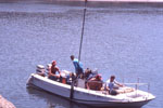
Equipment Used: Handheld GPS, Ponar grab sampler
Information to be Derived: Grain size, TOC, PAH, elemental composition.
Summary of Activity and Data Gathered: Sample locations on FAD 10/1/2018 Twenty three grab samples were collected; the surface 0-2 cm were preserved for geochemical analyses.
Staff: Cordell Johnson, Rachel Marcuson
Affiliate Staff:
Notes: Funding Project: Priority Ecosystems Mini-Proposal
Location:
San Pablo Bay to Honker Bay, California
| Boundaries | |||
|---|---|---|---|
| North: 38.14564366 | South: 38.01506011 | West: -122.53825802 | East: -121.88881683 |
Platform(s):
 Fast Eddy (SC) |
Takesue, R.K., 2020, Geochemistry of sediment and organic matter in drainages burned by the Altas and Nuns wildfires in October 2017 and of nearshore seabed sediment in north San Francisco Bay from March to April 2018: U.S. Geological Survey data release, https://doi.org/10.5066/P9VDTDSC.
Takesue, R.K., Conaway, C.H., and Tipple, B.J., 2021, Parent and alkylated polycyclic aromatic hydrocarbons (PAHs) and per- and polyfluoroalkyl substances (PFAS) in north San Francisco Bay, Napa River, and Sonoma Creek in 2018 and 2019: U.S. Geological Survey data release, https://doi.org/10.5066/P9B080YI.
| Survey Equipment | Survey Info | Data Type(s) | Data Collected |
|---|---|---|---|
| Handheld GPS | --- | Navigation | |
| Ponar grab sampler | --- | Biology Chemistry Geology |