AKA: none
Other ID: none
Status: Completed
Organization(s): USGS, Pacific Coastal and Marine Science Center
Funding Program(s): Tsunami Hazards, Modeling, and the Sedimentary Record (ZP00ES5)
Principal Investigator(s): SeanPaul La Selle
Affiliate Investigator(s): Alan Nelson (USGS)
Information Specialist(s): SeanPaul La Selle
Data Type(s): Imagery: Photo, Location-Elevation: Navigation, Sampling: Geology
Scientific Purpose/Goals: To map out, sample, and date tsunami deposits and subsidence events from past Cascadia earthquakes.
Vehicle(s): MarFac; Expedition G62-3094P
Start Port/Location: Manzanita, OR
End Port/Location: Manzanita, OR
Start Date: 2018-05-12
End Date: 2018-05-19
Equipment Used: camera, Handheld GPS, Hand-grab sample, Push corer
Information to be Derived: deposit thickness, grain size, ct scans, radiocarbon ages
Summary of Activity and Data Gathered: Cored at 39 locations, collected 27 samples for grain size, two 50 cm gouge cores for CT scanning and OSL dating.
Staff:
Affiliate Staff:
Notes:
Location:
Salmon River and Cannon Beach, OR
| Boundaries | |||
|---|---|---|---|
| North: 46.00134398 | South: 45.00574287 | West: -124.03255463 | East: -123.80589364 |
Platform(s):
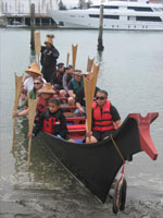 Canoe |
La Selle, S.M., Nelson, A.R., Witter, R.C., Jaffe, B.E., Gelfenbaum, G., and Padgett, J.S., 2024, Tsunami deposit data and sediment transport models from the Salmon River estuary, central Oregon: U.S. Geological Survey data release, https://doi.org/10.5066/P9M86S7D.
| Survey Equipment | Survey Info | Data Type(s) | Data Collected |
|---|---|---|---|
| camera | --- | Photo | |
| Handheld GPS | --- | Navigation | |
| Hand-grab sample | --- | Biology Chemistry Geology | |
| Push corer | --- | Chemistry Surveys (geochemical) Surveys (biological) Biology Geology |
