AKA: none
Other ID: none
Status: Completed
Organization(s): USGS, Pacific Coastal and Marine Science Center
Funding Program(s): Past, Present and Future Coral Reefs (ZP00FRV)
Principal Investigator(s): Curt Storlazzi
Affiliate Investigator(s): Lowe, Ryan (UWA); Hansen, Jeff (UWA); Pomeroy, Andrew (UWA)
Information Specialist(s): Joshua Logan
Data Type(s): Location-Elevation: Navigation, Sampling: Geology, Time Series: Mooring (physical oceanography)
Scientific Purpose/Goals: Determine controls on sediment transport from the fore reef to the shoreline.
Vehicle(s): None
Start Port/Location: Kaunakakai, Molokai, HI
End Port/Location: Kaunakakai, Molokai, HI
Start Date: 2018-09-17
End Date: 2018-09-26
Equipment Used: Other, Push corer, Moorings - Tripods
Information to be Derived: tide, wave height, wave period, wave direction, current speed, current direction, optical backscatter, acoustic backscatter, imagery.
Summary of Activity and Data Gathered: Mooring data submitted to FAD by Josh Logan 12/19/2018; archived under FAN 2018-617-FA.
Staff:
Affiliate Staff:
Notes: Entries for this field activity are based on entries from Field Activity 2018-617-FA
Location:
South Molokai, Hawaii
| Boundaries | |||
|---|---|---|---|
| North: 21.10437892 | South: 21.06947819 | West: -157.19755503 | East: -157.12607593 |
Platform(s):
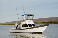
 Alyce C |
| Survey Equipment | Survey Info | Data Type(s) | Data Collected |
|---|---|---|---|
| Other | --- | --- | --- |
| Push corer | --- | Chemistry Surveys (geochemical) Surveys (biological) Biology Geology | |
| Moorings - Tripods | --- | Mooring (physical oceanography) |