AKA: none
Other ID: none
Status: Completed
Organization(s): USGS, Pacific Coastal and Marine Science Center
Funding Program(s): Other (Other)
Principal Investigator(s): Jenna Hill, Janet Watt
Affiliate Investigator(s): Melanie Michalak, Humboldt State Univ. Daniel O'Shea, Humboldt State Univ.
Information Specialist(s): Alicia Balster-gee, Janet Watt
Data Type(s): Electro-Magnetic: Magnetics, Location-Elevation: Navigation, Seismics: Multichannel, Seismics: Sparker, Seismics: Sub Bottom Profiler
Scientific Purpose/Goals: Characterize Quaternary deformation and sediment dynamics along the southern Cascadia margin
Vehicle(s): Mitsubishi Outlander G61-0912R
Start Port/Location: Eureka, CA
End Port/Location: Eureka, CA
Start Date: 2018-10-04
End Date: 2018-10-18
Equipment Used: Magnetometer, GPS, Other, Multichannel, 512 chirp-source, 512 chirp, Sparker
Information to be Derived: seismic imagery, marine magnetics
Summary of Activity and Data Gathered: MCS_Raw and Chirp data submitted to FAD 10/2/2018; Janet Watt
Staff:
Affiliate Staff:
Notes:
Location:
Southern Cascadia from Cape Blanco to the Mendocino Triple Junction
| Boundaries | |||
|---|---|---|---|
| North: 43.25108812 | South: 40.14849082 | West: -125.38574219 | East: -123.48388672 |
Platform(s):
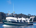 Coral Sea |
Balster-Gee, A.F., Kluesner, J.W., Watt, J.T., Hill, J.C., Brothers, D.S., Michalak, M.J., and O'Shea, D., 2020, Multichannel sparker seismic reflection data of USGS field activity 2018-658-FA collected between Cape Blanco and Cape Mendocino from 2018-10-04 to 2018-10-18: U.S. Geological Survey data release, https://doi.org/10.5066/P9R3QM97.
Balster-Gee, A.F., Kluesner, J.W., Watt, J.T., Hill, J.C., Brothers, D.S., Michalak, M.J., and OShea, D., 2023, Multichannel sparker and chirp seismic reflection data collected during USGS field activity 2018-658-FA between Cape Blanco and Cape Mendocino in October of 2018: U.S. Geological Survey data release, https://doi.org/10.5066/P9MYL7WJ.
| Survey Equipment | Survey Info | Data Type(s) | Data Collected |
|---|---|---|---|
| Magnetometer | --- | Magnetics | |
| GPS | --- | Navigation | |
| Other | --- | --- | --- |
| Multichannel | --- | Multichannel | Multichannel sparker seismic reflection data (This data release contains processed high-resolution multichannel sparker seismic-reflection (MCS) data that were collected aboard Humboldt State University's R/V Coral Sea. MCS data were collected to characterize quaternary deformation and sediment dynamics along the southern Cascadia margin. MCS data were collected coincidentally with chirp sub-bottom data.) |
| 512 chirp-source | --- | Sub Bottom Profiler | |
| 512 chirp | --- | Sub Bottom Profiler | Chirp sub-bottom data (This data release contains processed chirp sub-bottom data that were collected aboard Humboldt State University's R/V Coral Sea. MCS data were collected to characterize quaternary deformation and sediment dynamics along the southern Cascadia margin. Chirp sub-bottom data were collected coincident with sparker MCS data.) |
| Sparker | --- | Sparker |
