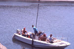
AKA: DL168
Other ID: none
Status: Completed
Organization(s): USGS, Pacific Coastal and Marine Science Center
Funding Program(s): Sediment Transport in Coastal Environments (ZP00FDB)
Principal Investigator(s): Jessica Lacy
Affiliate Investigator(s):
Information Specialist(s): Evan Dailey, Peter Dal Ferro
Data Type(s): Location-Elevation: Navigation, Sampling: Geology
Scientific Purpose/Goals: To improve the scientific basis for shallow water habitat restoration to support fisheries in the San Francisco Bay Delta, in collaboration with scientists from the CA Water Science Center.
Vehicle(s): MarFac; crewcab - G63-2147R
Start Port/Location: Rio Vista, CA
End Port/Location: Rio Vista, CA
Start Date: 2018-09-17
End Date: 2018-09-17
Equipment Used: Push corer, Garmin
Information to be Derived: Grain size and bulk density of bed sediments.
Summary of Activity and Data Gathered: Collected push cores of bottom sediment at four locations.
Staff: Evan Dailey, Peter Dal Ferro
Affiliate Staff:
Notes: Entries for this field activity are based on entries from Field Activity 2018-644-FA
Location:
San Francisco Bay Delta, Little Holland Tract, California
| Boundaries | |||
|---|---|---|---|
| North: 38.34440275 | South: 38.22842333 | West: -121.729 | East: -121.63231728 |
Platform(s):
 Fast Eddy (SC) |
| Survey Equipment | Survey Info | Data Type(s) | Data Collected |
|---|---|---|---|
| Push corer | --- | Chemistry Surveys (geochemical) Surveys (biological) Biology Geology | |
| Garmin | Use to locate sampling sites. | Navigation |