Other ID: 2019-619-FA
Status: Pending
Organization(s): USGS, Pacific Coastal and Marine Science Center, USGS, Woods Hole Coastal and Marine Science Center
Funding Program(s): USGS GAS HYDRATES (LQ000FP)
Principal Investigator(s): Carolyn Ruppel
Affiliate Investigator(s): Nancy Prouty (PCMSC); Amanda Demopoulos (WERC, Gainesville); Tamara Baumberger (NOAA PMEL); Jens Greinert (GEOMAR)
Information Specialist(s): Carolyn Ruppel
Data Type(s): Biological Field Study: Surveys (biological), Imagery: Video, Location-Elevation: Navigation, Sonar: Multibeam, Sonar: Single Beam
Scientific Purpose/Goals: ROV and geophysical studies of methane seepage on the Cascadia margin
Vehicle(s):
Start Port/Location: San Francisco, CA
End Port/Location: Astoria, OR
Start Date: 2019-06-12
End Date: 2019-07-02
Equipment Used: SIMRAD EK60, EM122 12 kHz multibeam, Other, Other
Information to be Derived: seafloor maps, subseafloor maps, gas seep characterization, methane flux, methane oxidation rate
Summary of Activity and Data Gathered: Telepresence-enabled cruise with ROV dives from southern Oregon margin through Grays Canyon, Washington, including CTDs, overnight multibeam and EK80 seafloor/water column mapping, and seafloor experiments led by GEOMAR and NOAA PMEL. Extensive web presence on USGS websites.
Staff: Bill Danforth
Affiliate Staff:
Alex Demas (USGS OCAP)
Notes: This was a competitively chosen project for which Schmidt Ocean Institute is providing about $1 million in shiptime on the global class R/V Falkor. We are responsible for travel, shipping, other science, overtime, etc.
Location:
U.S. Cascadia (Pacific Northwest) margin, offshore Washington and Oregon
| Boundaries | |||
|---|---|---|---|
| North: 48.21672332 | South: 41.85895216 | West: -127.24854111 | East: -124.58936142 |
Platform(s):
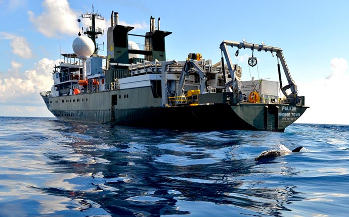 Falkor |
| Title | Survey Equipment | Description |
|---|---|---|
| Document 1143 | EM122 12 kHz multibeam | Released through R2R |
| Survey Equipment | Survey Info | Data Type(s) | Data Collected |
|---|---|---|---|
| SIMRAD EK60 | --- | Surveys (biological) Surveys (geochemical) Multibeam Water column reflectivity | |
| EM122 12 kHz multibeam | --- | Multibeam | |
| Other | --- | --- | --- |
| Other | --- | --- | --- |
