Other ID: none
Status: Completed
Organization(s): USGS, Woods Hole Coastal and Marine Science Center
Funding Program(s): Massachusetts Integrated Coastal Studies (LQ00M0Z)
Principal Investigator(s): Laura Brothers
Affiliate Investigator(s):
Information Specialist(s): Seth Ackerman, David Foster
Data Type(s): Location-Elevation: Navigation, Seismics: Boomer, Seismics: Multichannel, Seismics: Sub Bottom Profiler, Sonar: Multibeam, Sonar: Sound Velocity
Scientific Purpose/Goals: To define the geologic framework of Cape Cod Bay to aid the state of Massachusetts in management and assessment of resources and hazards
Vehicle(s):
Start Port/Location: Woods Hole, MA
End Port/Location: Woods Hole, MA
Start Date: 2019-08-01
End Date: 2019-08-29
Equipment Used: GeoEel digital streamer, POS-MV, Chirp 512i (sp), S-Boom seismic source, Reson T20-P, Sensor - MVP30 (Odim)
Information to be Derived: seafloor composition, morphology and underlying geologic framework
Summary of Activity and Data Gathered: From Aug 1-29, 2019 USGS collected geophysical data aboard the M/V Warren Jr. in Cape Cod Bay, MA. We collected 4700 trackline kilometers of multibeam and 512i chirp data. We collected 570 trackline kilometers of multi-channel seismic data (s-boom source) and 474 sound velocity profiles.
Staff: Seth Ackerman, Brian Andrews, Wayne Baldwin, Laura Brothers, William Danforth, David Foster, Barry Irwin, Eric Moore, Alexander Nichols, Charles Worley, Joseph Fredericks, Daniel Kennedy
Affiliate Staff:
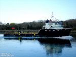
Notes: Platform: M/V Warren Jr.
need to input streamer configuration
Location:
Cape Cod Bay, Massachusetts, United States, Atlantic Ocean
| Boundaries | |||
|---|---|---|---|
| North: 42.06968463 | South: 41.73135491 | West: -70.52398682 | East: -70.08865356 |
Platform(s):
 M/V Warren JR |
Ackerman, S.D., Foster, D.S., Andrews, B.D., Danforth, W.W., Baldwin, W.E., Huntley, E.C., Worley, C.R., and Brothers, L.L., 2022, High-resolution geophysical and geological data collected in Cape Cod Bay, Massachusetts during USGS Field Activities 2019-002-FA and 2019-034-FA (ver. 2.0, September 2022): U.S. Geological Survey DRB data release, https://doi.org/10.5066/P99DR4PN.
| Survey Equipment | Survey Info | Data Type(s) | Data Collected |
|---|---|---|---|
| GeoEel digital streamer | The streamer was configured as a 32-channel streamer. | Boomer Multichannel Sparker Air Gun / Water Gun Bubble Gun | 2019-002-FA_MCS (Multichannel seismic-reflection and navigation data collected using an Applied Acoustics S-Boom and a Geometrics GeoEel digital 32-channel streamer during USGS field activity 2019-002-FA in Cape Cod Bay, Massachusetts (point and polyline shapefiles, CSV text, PNG Images, and SEG-Y data, GCS WGS 84)) |
| POS-MV | --- | Navigation | |
| Chirp 512i (sp) | --- | Sub Bottom Profiler | 2019-002-FA_SB512i (Chirp seismic reflection - shotpoints, tracklines, profile images, and SEG-Y traces for EdgeTech SB-512i chirp data collected during USGS field activity 2019-002-FA in Cape Cod Bay, Massachusetts (point and polyline shapefiles, CSV text, PNG Images, and SEGY data, GCS WGS 84)) |
| S-Boom seismic source | --- | Boomer | |
| Reson T20-P | --- | Multibeam Water column reflectivity | 2019-002-FA_T20P_Backscatter_1m (Multibeam backscatter data collected in Cape Cod Bay, Massachusetts during USGS Field Activity 2019-002-FA, using a dual-head Reson T20-P multibeam echo sounder (8-bit GeoTIFF, UTM Zone 19N, WGS84, 1-m resolution)) 2019-002-FA_T20P_Bathymetry_5m_MLLW (Multibeam bathymetric data collected in Cape Cod Bay, Massachusetts during USGS Field Activity 2019-002-FA, using a dual-head Reson T20-P multibeam echo sounder (32-bit GeoTIFF, UTM Zone 19N, NAD 83, MLLW Vertical Datum, 5-m resolution) (version 2)) 2019-002-FA_T20P_Tracklines (Multibeam sonar tracklines collected in Cape Cod Bay, Massachusetts with a Reson T-20P during USGS Field Activity 2019-002-FA (Esri polyline shapefile, GCS WGS 84)) |
| Sensor - MVP30 (Odim) | --- | Sound Velocity | 2019-002-FA_MVPSVP_data (Sound velocity profile data from an AML Oceanographic MVP30 and Minos X collected in Cape Cod Bay, Massachusetts during USGS Field Activity 2019-002-FA (PNG images, SVP text, and point shapefile, GCS WGS 84)) |
