Other ID: none
Status: Completed
Organization(s): USGS, Woods Hole Coastal and Marine Science Center
Funding Program(s): Massachusetts Integrated Coastal Studies (LQ00M0Z)
Principal Investigator(s): Laura Brothers
Affiliate Investigator(s):
Information Specialist(s): Seth Ackerman
Data Type(s): Imagery: Photo, Imagery: Video, Sampling: Geology
Scientific Purpose/Goals: Geologic sampling of the seafloor
Vehicle(s):
Start Port/Location: Woods Hole, MA
End Port/Location: Woods Hole, MA
Start Date: 2019-09-16
End Date: 2019-09-19
Equipment Used: GoPro camera, SeaBOSS, SeaViewer 6000 HD Sea-Drop video camera, Nikon 7100 digital camera, Paralenz Dive Camera +
Information to be Derived: Seafloor texture and character
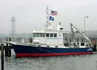
Summary of Activity and Data Gathered: From Sept 17-Sept 19, 2019 aboard the R/V Tioga, at 49 sites we collected photo, video and grab samples. Cape Cod Bay, MA.
Staff: Seth Ackerman, Laura Brothers, Dann Blackwood, Charles Worley, David Foster, Wayne Baldwin, Eric Moore, Alexander Nichols
Affiliate Staff:
Notes: Entries for this field activity are based on entries from Field Activity 2017-22
FA 2019-034 is affiliated with geophysical cruise FA 2019-002.
Cruise consisted of two day trips (Sept 17 and Sept 18), with different crews.
Location:
Cape Cod Bay
| Boundaries | |||
|---|---|---|---|
| North: 42.32606244 | South: 41.54147767 | West: -71.27929688 | East: -69.16992188 |
Platform(s):
 Tioga |
Ackerman, S.D., Foster, D.S., Andrews, B.D., Danforth, W.W., Baldwin, W.E., Huntley, E.C., Worley, C.R., and Brothers, L.L., 2022, High-resolution geophysical and geological data collected in Cape Cod Bay, Massachusetts during USGS Field Activities 2019-002-FA and 2019-034-FA (ver. 2.0, September 2022): U.S. Geological Survey DRB data release, https://doi.org/10.5066/P99DR4PN.
| Survey Equipment | Survey Info | Data Type(s) | Data Collected |
|---|---|---|---|
| GoPro camera | --- | Photo Video | 2019-034-FA_photos (Geotagged sea-floor images and locations of bottom images collected in Cape Cod Bay, Massachusetts, in September 2019 by the U.S. Geological Survey during field activity 2019-034-FA (JPEG images, point shapefile, and CSV file; GCS WGS 84)) |
| SeaBOSS | --- | Surveys (biological) Experiments (biological) Species ID Photo Video Geology Biology | 2019-034-FA_samples (Locations and grain-size analysis results of sediment samples collected in Cape Cod Bay, Massachusetts, in September 2019 by the U.S. Geological Survey during field activity 2019-034-FA (point shapefile and CSV file, GCS WGS 84, MLLW vertical datum)) |
| SeaViewer 6000 HD Sea-Drop video camera | --- | Video | 2019-034-FA_videos (Sea-floor videos and locations of bottom video tracklines collected in Cape Cod Bay, Massachusetts, in September 2019 by the U.S. Geological Survey during field activity 2019-034-FA (MP4 video files and polyline shapefile, GCS WGS 84)) |
| Nikon 7100 digital camera | --- | Photo | |
| Paralenz Dive Camera + | --- | Video |