AKA: none
Other ID: 2019-003-FA (WHCMSC), 2019-314-FA (Kellog St. Pete), RB-19-03 (NOAA)
Status: Completed
Organization(s): USGS, Pacific Coastal and Marine Science Center, USGS, St. Petersburg Coastal and Marine Science Center, USGS, Woods Hole Coastal and Marine Science Center
Funding Program(s): Other (Other)
Principal Investigator(s): Nancy Prouty
Affiliate Investigator(s): Christina Kellogg (St. Pete), Jason Chaytor (Woods Hole)
Information Specialist(s): Nancy Prouty
Data Type(s): Environmental Data: CTD, Location-Elevation: Navigation, Sampling: Biology, Sampling: Chemistry, Sampling: Geology, Visual Identification: Submersible Observations
Scientific Purpose/Goals: Sample collection to determine coral microbiomes and benthic habitat metagenomes
Vehicle(s): None
Start Port/Location: Charleston, SC
End Port/Location: Charleston, SC
Start Date: 2019-04-09
End Date: 2019-04-30
Equipment Used: CTD_SeaBird, Other, grabs, Other, Niskenbottle, Submersible observations
Information to be Derived: DNA sequences, geologic substrate, coral age dating, sediment provenance
Summary of Activity and Data Gathered: 1. Exploration of new sites and new areas within known sites 2. Sampling of corals and associated fauna for biodiversity and biogeography 3. Community sampling at seep and coral habitats 4. Sediment sampling at soft sediment sites for biogeochemistry and diversity 5. Collections of corals for live coral experiments 6. Water sampling for water chemistry and microbial diversity 7. Sediment, water, and faunal samples for eDNA work 8. Geological observations and sampling for geomorphology 9. Lander deployments
Staff:
Affiliate Staff:
Notes: This survey is being conducted in collaboration with scientists from the USGS (Woods Hole and St. Petersburg offices) and NOAA. Additional details for the WHCSMC survey can be found at: https://cmgds.marine.usgs.gov/fan_info.php?fan=2019-003-FA.
Entries for this field activity are based on entries from Field Activity 2019-314-FA
Location:
Atlantic Ocean off SE US
| Boundaries | |||
|---|---|---|---|
| North: 37.031 | South: 31.079 | West: -78.322 | East: -74.503 |
Platform(s):
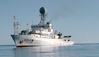 Ronald H. Brown | 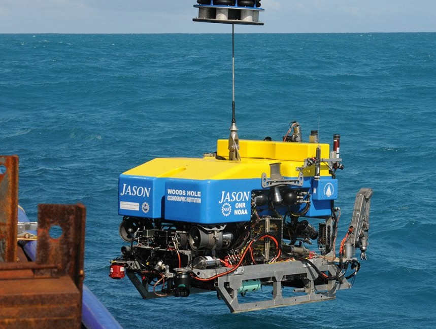 ROV Jason |
Prouty, N.G., and Baker, M.C., 2021, Water-column environmental variables and accompanying discrete CTD measurements collected offshore the U.S. Mid- and South Atlantic (ver. 2.0, July 2022): U.S. Geological Survey data release, https://doi.org/10.5066/P9K2GOAL.
Prouty, N.G., and Chaytor, J.D., 2022, Carbonate chemistry measurements of authigenic carbonates collected offshore the U.S. Mid- and South Atlantic in 2018 and 2019 as part of the DEEPSEARCH Project: U.S. Geological Survey data release, https://doi.org/10.5066/P9DRU8TP.
| Survey Equipment | Survey Info | Data Type(s) | Data Collected |
|---|---|---|---|
| CTD_SeaBird | --- | CTD | |
| Other | --- | --- | --- |
| grabs | --- | Geology | |
| Other | --- | --- | --- |
| Niskenbottle | --- | Chemistry | |
| Submersible observations | --- | Species ID Submersible Observations |
