AKA: Elwha 2019 summer survey
Other ID: none
Status: Completed
Organization(s): USGS, Pacific Coastal and Marine Science Center
Funding Program(s): Coastal Habitats in Puget Sound (ZP00AZZ)
Principal Investigator(s): Jonathan Warrick
Affiliate Investigator(s):
Information Specialist(s): Andrew Stevens
Data Type(s): Imagery: Photo, Location-Elevation: Navigation, Location-Elevation: Transects, Sampling: Geology, Sonar: Single Beam, Sonar: Sound Velocity
Scientific Purpose/Goals: Collect nearshore bathymetry, beach topography, and grain size information on the Elwha River delta
Vehicle(s): MarFac; Expedition G62-3094P
Start Port/Location: Port Angeles, WA
End Port/Location: Port Angeles, WA
Start Date: 2019-08-26
End Date: 2019-08-29
Equipment Used: camera, Trimble R7 GPS (AS), Trimble R7 GPS receiver, Trimble R7 GPS receiver 9, Waverunners, Ponar grab sampler, soundvelocityprofiler
Information to be Derived: Nearshore Bathymetry, Beach Topography, Surface Grainsize
Summary of Activity and Data Gathered: Nearshore bathymetry, beach topography
Staff: Jackson Currie, Timothy Elfers, Andrew Ritchie, Andrew Stevens, Jonathan Warrick
Affiliate Staff:
Notes: Entries for this field activity are based on entries from Field Activity 2014-649-FA
Entries for this field activity are based on entries from Field Activity 2015-605-FA
Entries for this field activity are based on entries from Field Activity 2015-648-FA
Entries for this field activity are based on entries from Field Activity 2016-608-FA
Entries for this field activity are based on entries from Field Activity 2016-653-FA
Entries for this field activity are based on entries from Field Activity 2017-638-FA
Entries for this field activity are based on entries from Field Activity 2018-648-FA
Location:
Puget Sound
| Boundaries | |||
|---|---|---|---|
| North: 48.17624572 | South: 48.10493829 | West: -123.633 | East: -123.38360665 |
Platform(s):
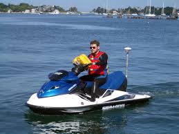
 Waverunner 1 (SC) |  Waverunner 2 (SC) |
Stevens, A.W., Gelfenbaum, G.R., Warrick, J.A., Miller, I.M., and Weiner, H.M., 2024, Bathymetry, topography, and sediment grain-size data from the Elwha River delta, Washington, August 2019: U.S. Geological Survey data release, https://doi.org/10.5066/P9CR1ABQ.
| Survey Equipment | Survey Info | Data Type(s) | Data Collected |
|---|---|---|---|
| camera | --- | Photo | |
| Trimble R7 GPS (AS) | --- | Benchmarks Navigation Profiles Transects | |
| Trimble R7 GPS receiver | --- | Benchmarks LIDAR Navigation Profiles Transects | Topography data from the Elwha River delta, Washington, August 2019 (Topography data were collected on foot with global navigation satellite system (GNSS) receivers mounted on backpacks.) |
| Trimble R7 GPS receiver 9 | --- | Benchmarks LIDAR Navigation Profiles Transects | |
| Waverunners | --- | Navigation Single Beam | |
| Ponar grab sampler | --- | Biology Chemistry Geology | Surface-sediment grain-size distributions of the Elwha River delta, Washington, August 2019 (Surface sediment was collected from 77 locations using a small ponar, or 'grab', sampler from the R/V Frontier in water depths between about 1 and 17 m around the delta. An additional 30 samples were collected by hand at low tide.) |
| soundvelocityprofiler | --- | Sound Velocity | Nearshore bathymetry data from the Elwha River delta, Washington, August 2019 (Bathymetric data were collected using personal watercraft (PWCs) equipped with single-beam sonar systems and global navigation satellite system (GNSS) receivers.) |