AKA: San Francisco Sand Resources
Other ID: none
Status: Completed
Organization(s): USGS, Pacific Coastal and Marine Science Center
Funding Program(s): Other (Other)
Principal Investigator(s): James Conrad, Thomas Lorenson
Affiliate Investigator(s):
Information Specialist(s): Antoinette Papesh
Data Type(s): Electro-Magnetic: Magnetics, Location-Elevation: Navigation, Sampling: Geology, Seismics: Sub Bottom Profiler
Scientific Purpose/Goals: Assessment of Sand Resources offshore San Francisco Bay
Vehicle(s): Dodge Caravan - G41-2395R
Start Port/Location: Alameda, CA
End Port/Location: Alameda, CA
Start Date: 2019-10-11
End Date: 2019-10-18
Equipment Used: Magnetometer, GPS, Van Veen, Vibracore, 512 chirp-source, subbottomprofiler
Information to be Derived: Seismic reflection profiles, sediment grain size, magnetic field intensity
Summary of Activity and Data Gathered: 35 vibracores; 512 chirp sub bottom profiler and towed magnetic measurements along many short lines totaling 960km
Staff: James Conrad, Cordell Johnson, Daniel Kennedy, Thomas Lorenson, Rachel Marcuson, Jennifer McKee, Antoinette Papesh
Affiliate Staff:
Notes: Project: BOEM Significant Sand Resource
Location:
San Francisco, California, United States, Pacific Ocean
| Boundaries | |||
|---|---|---|---|
| North: 38.01347623 | South: 37.49665234 | West: -122.87083994 | East: -122.39324246 |
Platform(s):
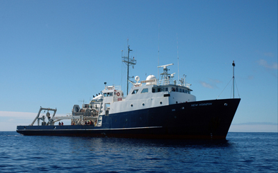 Bold Horizon |
Sliter, R.W., Conrad, J.E., Lorenson, T.D., Papesh, A.G., Balster-Gee, A.F., Watt, J.T., and Warrick, J.A., 2021, Geophysical and core sample data collected offshore San Francisco, California, during field activity 2019-649-FA from 2019-10-11 to 2019-10-18: U.S. Geological Survey data release, https://doi.org/10.5066/P9LBG9H5.
Sliter, R.W., Conrad, J.E., Lorenson, T.D., Papesh, A.G., Balster-Gee, A.F., Watt, J.T., and Warrick, J.A., 2021, Geophysical and core sample data collected offshore San Francisco, California, during field activity 2019-649-FA from 2019-10-11 to 2019-10-18: U.S. Geological Survey data release, https://doi.org/10.5066/P9LBG9H5.
| Survey Equipment | Survey Info | Data Type(s) | Data Collected |
|---|---|---|---|
| Magnetometer | --- | Magnetics | Marine magnetic data collected offshore San Francisco, California (This part of the data release contains marine magnetic data that were collected aboard the R/V Bold Horizon in 2019 on U.S. Geological Survey Field Activity 2019-649-FA offshore San Francisco, California.) |
| GPS | --- | Navigation | |
| Van Veen | --- | Biology Geology | |
| Vibracore | --- | Chemistry Geology | Core logger data from vibracores collected offshore San Francisco, California (This section of the data release contains core logger tabular data of 34 vibracores that were collected aboard the R/V Bold Horizon in 2019 on U.S. Geological Survey Field Activity 2019-649-FA offshore San Francisco, California. The cores were analyzed for gamma ray density and magnetic susceptibility. The logging was performed at 1-cm intervals from the top of each core section. In addition to the core logger data, the locations of the cores are available as either a comma-delimited file or a shapefile.) Sediment grain-size data from vibracore samples collected offshore San Francisco, California (This section of the data release contains grain-size and total organic carbon (TOC) analyses of 132 samples taken from vibracores that were collected aboard the R/V Bold Horizon in 2019 on U.S. Geological Survey Field Activity 2019-649-FA offshore San Francisco, California. The samples were analyzed for percent weight of grain size and total organic carbon. The samples were taken at approx. 50 cm intervals from (and including) the core-catcher, which represents the bottom of the core.) Photographs of vibracores collected offshore San Francisco, California (This section of the data release contains photographs of 34 vibracores that were collected aboard the R/V Bold Horizon in 2019 on U.S. Geological Survey Field Activity 2019-649-FA offshore San Francisco, California. Continuous line-scan photographs were created in the lab to assess sand and gravel resources in Federal and State waters for potential use in future beach nourishment projects along stretches of the coast where critical erosion hotspots have been identified.) |
| 512 chirp-source | --- | Sub Bottom Profiler | |
| subbottomprofiler | --- | Sub Bottom Profiler | High-resolution chirp seismic-reflection data collected offshore San Francisco, California, during field activity 2019-649-FA from 2019-10-11 to 2019-10-18 (This part of the data release contains approximately 783 line-kilometers of processed, high-resolution, chirp seismic-reflection data that were collected aboard the R/V Bold Horizon in 2019 on U.S. Geological Survey cruise 2019-649-FA offshore San Francisco, California. The chirp profiles were acquired using an Edgetech 3200 5-16 chirp sub-bottom profiling system. These data are divided up and presented by navigation line, as reflected in the individual file names.) |
