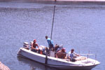
AKA: Thermal Little Holland Tract
Other ID: none
Status: Cancelled
Organization(s): USGS, Pacific Coastal and Marine Science Center
Funding Program(s): Coastal Aquifer Project - [CAPII] (ZP000I4)
Principal Investigator(s): Ferdinand Oberle
Affiliate Investigator(s):
Information Specialist(s): Joshua Logan
Data Type(s): Imagery: Other Imagery
Scientific Purpose/Goals: Record thermal drone data in fish habitat.
Vehicle(s): MarFac; Ford F350 MT use only; pickup - white; G43-2784H
Start Port/Location: Rio Vista, CA
End Port/Location: Rio Vista, Ca
Start Date: 2019-11-06
End Date: 2019-11-07
Equipment Used: FLIR thermal camera
Information to be Derived: Thermal
Summary of Activity and Data Gathered:
Staff:
Affiliate Staff:
Notes:
Location:
Little Holland Tract, California, United States
| Boundaries | |||
|---|---|---|---|
| North: 38.29155339 | South: 38.28394067 | West: -121.66851932 | East: -121.66131016 |
Platform(s):
 Fast Eddy (SC) |
| Survey Equipment | Survey Info | Data Type(s) | Data Collected |
|---|---|---|---|
| FLIR thermal camera | --- | Other Imagery |