Other ID: none
Status: Cancelled
Organization(s): USGS, Woods Hole Coastal and Marine Science Center
Funding Program(s):
Principal Investigator(s): Walter Barnhardt
Affiliate Investigator(s): Peter Esselman, GLSC
Information Specialist(s): Other
Data Type(s): Imagery: Photo, Imagery: Video, Sampling: Geology, Seismics: Sub Bottom Profiler, Sonar: Multibeam
Scientific Purpose/Goals: Geologic framework mapping within nearshore areas of Lake Ontario
Vehicle(s):
Start Port/Location: Woods Hole, MA
End Port/Location: Woods Hole, MA
Start Date: 2020-09-09
End Date: 2020-09-25
Equipment Used: SeaBOSS, EdgeTech 424 chirp sub-bottom profiler, Reson T20-P
Information to be Derived: bathymetry, backscatter, subbottom, bottom samples, bottom video and photos, sediment thickness
Summary of Activity and Data Gathered:
Staff: Other
Affiliate Staff:
Notes: Cancelled due to COVID. Cruise now planned for 2021.
Location:
Eastern Lake Ontario
| Boundaries | |||
|---|---|---|---|
| North: 44.10730981 | South: 43.78695837 | West: -76.39343262 | East: -76.04736328 |
Platform(s):
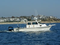
 Rafael |
| Survey Equipment | Survey Info | Data Type(s) | Data Collected |
|---|---|---|---|
| SeaBOSS | --- | Surveys (biological) Experiments (biological) Species ID Photo Video Geology Biology | |
| EdgeTech 424 chirp sub-bottom profiler | --- | Sub Bottom Profiler | |
| Reson T20-P | --- | Multibeam Water column reflectivity |