Other ID: none
Status: Cancelled
Organization(s): USGS, Woods Hole Coastal and Marine Science Center
Funding Program(s): National Seafloor Mapping and Benthic Habitat Studies: Atlantic (LQ000FO)
Principal Investigator(s): Page Valentine
Affiliate Investigator(s): Dr. David Wylie, SBNMS
Information Specialist(s): Seth Ackerman
Data Type(s): Environmental Data: CTD, Imagery: Video, Location-Elevation: Navigation, Sampling: Geology
Scientific Purpose/Goals: Collect seabed sediment samples for geological mapping project
Vehicle(s):
Start Port/Location: Scituate, MA
End Port/Location: Scituate, MA
Start Date: 2020-08-21
End Date: 2020-08-28
Equipment Used: SBE 19plus V2 SeaCAT Profiler CTD, GoPro camera, SeaBOSS, Furuno satellite compass SC-30
Information to be Derived: Sediment samples for geological mapping
Summary of Activity and Data Gathered:
Staff: Seth Ackerman
Affiliate Staff:
Notes: Travel to and from Scituate, MA for day-cruises to Stellwagen Bank.
CTD required as for previous cruises.
Load Auk in Scituate, MA on Friday, August 21, if possible, or Monday, August 24 (Valentine will not be available on Friday).
Canceled due to COVID.
Location:
Stellwagen Bank NMS
| Boundaries | |||
|---|---|---|---|
| North: 42.5 | South: 42 | West: -70.5 | East: -70 |
Platform(s):
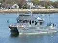 Auk |
| Survey Equipment | Survey Info | Data Type(s) | Data Collected |
|---|---|---|---|
| SBE 19plus V2 SeaCAT Profiler CTD | --- | CTD Fluorescence Turbidity | |
| GoPro camera | --- | Photo Video | |
| SeaBOSS | --- | Surveys (biological) Experiments (biological) Species ID Photo Video Geology Biology | |
| Furuno satellite compass SC-30 | --- | Navigation |
