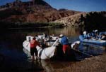
AKA: Garrison Lake, OR marsh coring and geophysics of Garrison and Floras Lake, OR.
Other ID: none
Status: Completed
Organization(s): USGS, Pacific Coastal and Marine Science Center
Funding Program(s): Tsunami Hazards, Modeling, and the Sedimentary Record (ZP00ES5)
Principal Investigator(s): SeanPaul La Selle
Affiliate Investigator(s): Bruce Jaffe, Brandon Nasr
Information Specialist(s): Brandon (Contractor) Nasr
Data Type(s): Sampling: Geology, Sonar: Sidescan
Scientific Purpose/Goals: To collect geophysical profile of lake bottom stratigraphy and to collect marsh core sediment data.
Vehicle(s): Ford Fusion HEV G10-6618K
Start Port/Location: Santa Cruz, CA
End Port/Location: Santa Cruz, CA
Start Date: 2020-09-18
End Date: 2020-09-29
Equipment Used: core, Edgetech 424
Information to be Derived: CHIRP sub bottom data, core imagery, X-ray scans, core descriptions.
Summary of Activity and Data Gathered: Geophysical data of Floras lake, Garrison lake, and Bradley lake were gathered. 6 marsh gouge core samples were collected and 20 surface samples were collected in whirlpaks. GPS data points were taken at each site cored and sampled.
Staff:
Affiliate Staff:
Notes:
Location:
Garrison Lake, Oregon, United States. Floras Lake, Oregon, United States.
| Boundaries | |||
|---|---|---|---|
| North: 42.76339792 | South: 42.74688611 | West: -124.51921413 | East: -124.49398088 |
Platform(s):
 Raft |
| Survey Equipment | Survey Info | Data Type(s) | Data Collected |
|---|---|---|---|
| core | --- | Biology Geology | |
| Edgetech 424 | --- | Sidescan |