AKA: Southern Monterey Bay 2020
Other ID: none
Status: Completed
Organization(s): USGS, Pacific Coastal and Marine Science Center
Funding Program(s): Climate Change Impacts to the U.S. Pacific and Arctic Coasts (ZP00F00)
Principal Investigator(s): Patrick Barnard, Jonathan Warrick
Affiliate Investigator(s):
Information Specialist(s): Alexander Snyder, Andrew Stevens
Data Type(s): Imagery: Photo, Location-Elevation: Navigation, Location-Elevation: Profiles, Sonar: Sound Velocity
Scientific Purpose/Goals: Collect nearshore bathymetry and beach topography in southern Monterey Bay
Vehicle(s): Elantra G13-2404R, MarFac; crewcab - G63-2147R, MarFac; Crysler G12-0254S, MarFac; Expedition G62-3094P
Start Port/Location: Moss Landing, CA
End Port/Location: Monterey, CA
Start Date: 2020-10-14
End Date: 2020-10-19
Equipment Used: camera, Structure from Motion - crewed aircraft, Trimble R10 GPS (AS), Trimble R7 GPS (AS), Trimble R7 GPS receiver, Trimble R7 GPS receiver 9, Trimble R7 GPS receiver (EG), YSI Sound velocity CTD
Information to be Derived: Beach topography, nearhsore bathymetry
Summary of Activity and Data Gathered: Collected nearshore bathymetry and beach topography data.
Staff: Jackson Currie, Amy Foxgrover, Daniel Hoover, Rachel Marcuson, Jennifer McKee, Alexander Snyder
Affiliate Staff:
Notes: Entries for this field activity are based on entries from Field Activity 2018-661-FA
Location:
Southern Monterey Bay
| Boundaries | |||
|---|---|---|---|
| North: 36.81767505 | South: 36.59381076 | West: -121.93123192 | East: -121.77439599 |
Platform(s):
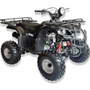
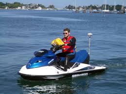
 ATV |  Waverunner 1 (SC) |  Waverunner 2 (SC) |
| Survey Equipment | Survey Info | Data Type(s) | Data Collected |
|---|---|---|---|
| camera | --- | Photo | |
| Structure from Motion - crewed aircraft | --- | Photo | |
| Trimble R10 GPS (AS) | --- | Navigation Profiles | |
| Trimble R7 GPS (AS) | --- | Benchmarks Navigation Profiles Transects | |
| Trimble R7 GPS receiver | --- | Benchmarks LIDAR Navigation Profiles Transects | |
| Trimble R7 GPS receiver 9 | --- | Benchmarks LIDAR Navigation Profiles Transects | |
| Trimble R7 GPS receiver (EG) | --- | Benchmarks LIDAR Navigation Profiles Transects | |
| YSI Sound velocity CTD | --- | CTD Sound Velocity |