Other ID: none
Status: Cancelled
Organization(s): USGS, Woods Hole Coastal and Marine Science Center
Funding Program(s): USGS GAS HYDRATES (LQ000FP)
Principal Investigator(s): Carolyn Ruppel
Affiliate Investigator(s): Chris Martens, UNC John Kessler, UR
Information Specialist(s): Carolyn Ruppel
Data Type(s): Sonar: Multibeam, Sonar: Water column reflectivity
Scientific Purpose/Goals: USGS goal: Map active seep sites near Bodie Island seep offshore Hatteras to support studies of in situ aerobic methane oxidation rates NOTE: Two 10 day cruises with EK80 between May 1 2021 and August 31 2021; dates TBA
Vehicle(s):
Start Port/Location: Lewes, DE
End Port/Location: Lewes, DE
Start Date: 2021-05-01
End Date: 2021-08-31
Equipment Used: SIMRAD EK60
Information to be Derived: water column imagery to support biogeochemical studies
Summary of Activity and Data Gathered:
Staff: Wayne Baldwin, William Danforth
Affiliate Staff:
Notes: EK80 with 38 kHz mounted in transducer well of R/V Sharp using existing mount
Location:
Hatteras
| Boundaries | |||
|---|---|---|---|
| North: 38.82259098 | South: 33.50475907 | West: -77.6953125 | East: -73.30078125 |
Platform(s):
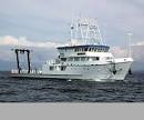 Hugh R. Sharp |
| Survey Equipment | Survey Info | Data Type(s) | Data Collected |
|---|---|---|---|
| SIMRAD EK60 | --- | Surveys (biological) Surveys (geochemical) Multibeam Water column reflectivity |
